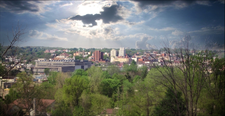
It has been well established in 2,800 years of world lore that the ancient City of Rome was built upon a series of seven hills. The fabled ‘Seven Hills of Rome’ was a common trope throughout early American culture as the nation took root, and then schoolbooks in the 19th and 20th centuries gave the expression relevance to generations of Ohio kids.
So when authors, planners, leaders, and speakers suggested that the City of Mansfield was built upon Seven Hills, everyone knew exactly what that meant, and what kind of epic fate and grandeur it was intended to imply.
Local civic enthusiasts first wrote of the city’s topography in terms of Seven Hills in 1850s newspapers. It became a matter of national record in the 1920s when the Lincoln Highway passed through town and the Seven Hills were mentioned in guidebook literature.
The most prominent endorsement of the idea, however, came in 1927 when acclaimed author Louis Bromfield wrote in his best-selling novel:
The Town stood built like Rome upon Seven Hills, which were great monuments of earth and stone left by the last great glacier, and on these seven hills and in the valleys which surrounded them a whole city, created within the space of less than a century, had raised houses and shops…
A Good Woman, p.72
In the days of Bromfield’s childhood, the people of Mansfield were much more aware of the hills than we are today. In a world where people walked or drove teams of horses to get where they were going, they were far more conscious of the effort it took to get up or down a steep hill. In today’s world, we have lost a great deal of that awareness because the automobile has leveled the energy it takes to go from one part of town to another.
But in earlier days, everyone visiting the town arrived on the train, which stopped in the Flats; and to get to downtown they had to go uphill. Writers from newspapers in other cities in Ohio like Cleveland, Columbus and Akron referred to Mansfield as the “City on a Hill.”

So what are the Seven Hills of Mansfield?
There is documentation from the 1920s and ’30s attempting to enumerate specific steep streets and neighborhoods as the designated hills of legend, but these lists vary according to whatever cause the writer was trying to promote.
I have undertaken to narrow the possibilities down using two criteria: the first is from traditional and folkloric names associated with sites—such as “Oak Hill.” The second criteria is far more fundamental in the understanding of practical city memory and usage—quite simply: where did the kids of earlier generations take their sleds? You can be sure the old toboggan run is a valid landmark hill.

1: Central Park
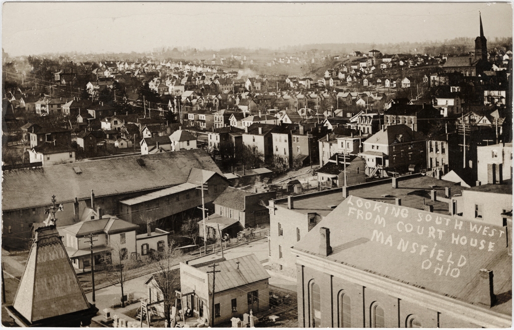
In the earliest literature concerning the city, the site upon which the Public Square was established was referred to as ‘the Mansfield heights.’ The placement of the center of town was made in relation to the nearest source of water, but it was clearly intended to stand atop a prominent hill with a view. Central Park is the original high ground.


2: Goat Hill
The most significant hill seen from the Square is to the south, and was for many generations commonly known as South Hill. People said that the cemetery was on South Hill.
In the city’s early decades, however, it was referred to in newsprint and diaries as Goat Hill. Back then, the County Fair Grounds were situated at the brink of the hill, in the area where today Lexington Avenue diverges from South Main Street. In the early 20th century, there was a Goat Hill Gun Club hosting a turkey shoot every year; and in the 1960s there was still a Goat Hill Garden Club.
The hill extends as a ridge to east and west, providing a number of steep streets: most notably the Hedges Street hill, that was known in 1907 as the ‘Mecca for coasters,” (sleds), when thousands of kids and parents showed up on icy nights to race downhill.
So how high IS Goat Hill?
When President Barack Obama came to make a speech in Mansfield in 2012, the Secret Service cordoned off a vacant house on Goat Hill—just off South Main Street at the end of Burnese Avenue—because an upper story window afforded a clear shot at the front of the Reeds Building, on the Square, where the podium was set.


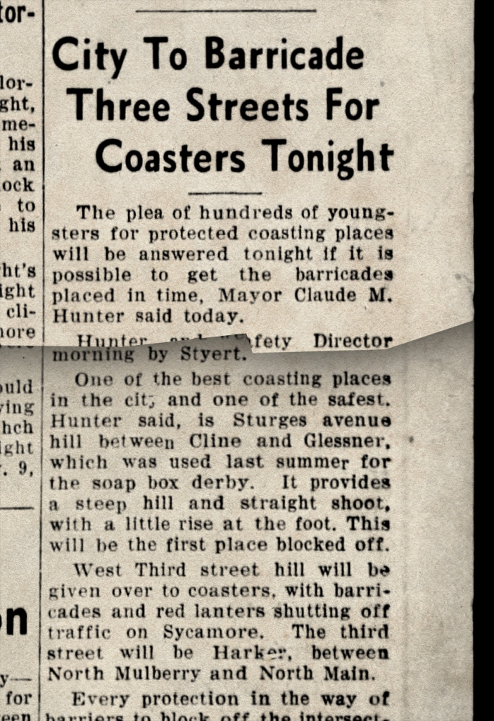
Sturges Hill
The most famous of Mansfield’s hills in the 1930s was Sturges Avenue Hill. The drop between Cline and Glessner Avenues was the site in 1937 of the first Soap Box Derby held in Mansfield.
The drop, 1,000 feet long and paved in bricks, provided enough gravity to propel Derby cars up to 35 MPH.
Studied carefully on a topographical map of the city, the Sturges hill is actually a separate angle of the Goat Hill/South Hill rise of Mansfield.


3: Clover Hill
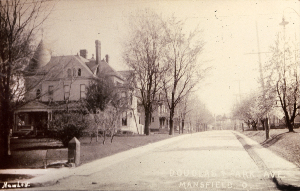
The major hill located west of Central Park rises from the southern curbs of Park Avenue West about a half-mile west of the Square. Referred to as Marion Avenue Hill in the 1920s, it was known in the 1800s as Clover Hill–named for the home and estate of early city benefactor Roeliff Brinkerhoff, at the corner of Bartley Avenue.
The steepest inclination of this hill is found at Sherman Avenue, where cars used to pile up on icy days. Before the city covered the land with houses and streets, this countryside hilltop was an apple orchard.

Mortgage Hill
Traveling west on West Third Street, the pavement rises suddenly into a significant hill at Sycamore Street: this is Mortgage Hill. So named in the early 20th century when Third Street was finally cut through the back of the Sherman Estate, and town lots there became available for building. Apparently they weren’t cheap.
Mortgage Hill is contiguous with Clover Hill, and is another side element of that west-end elevation.


4: Oak Hill
For the sake of identification, the hill rising NW of the tracks in Mansfield is designated here as Oak Hill–even though the actual site of Oak Hill Cottage makes up only a small element of that larger hilltop.
This area, known today as the North End community, was laid out in the 1910s-’20s anticipating an appreciable bump in population as the city’s industries blossomed. The neighborhoods there were known at that time as Bowman Heights because the view overlooking downtown made it evident that it was the city’s high ground.


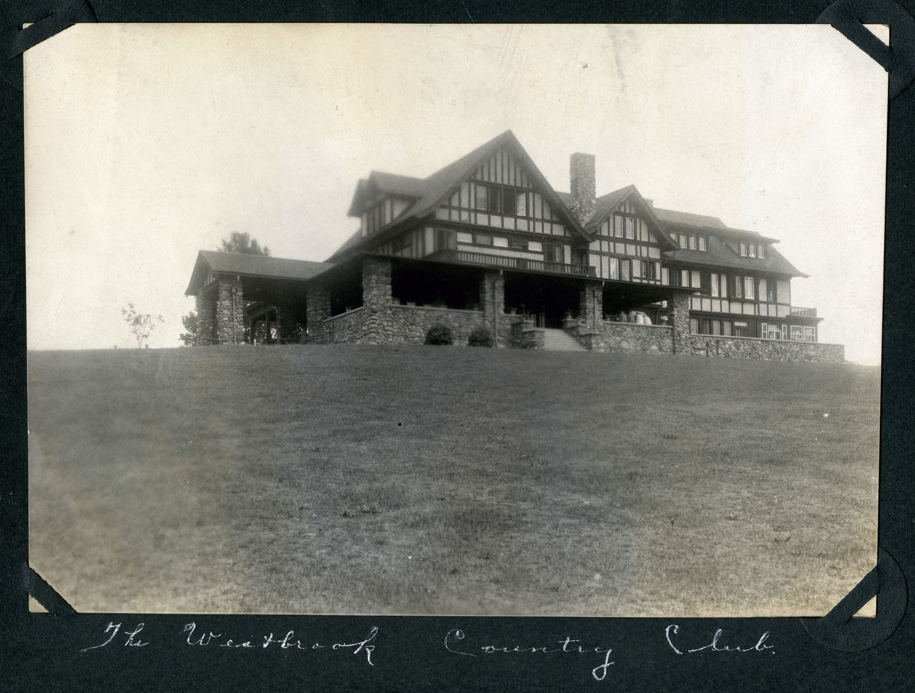
5: Lumbermens Hill
In our time it is still known as Lumbermens Hill, even though the Lumbermens Mutual Insurance Company’s offices closed more than 30 years ago. In the 1800s, the place was known as Geddes Hill because that was where Judge George W. Geddes established his estate. After he was gone, his home was appropriated by the insurance company, who eventually built an impressive complex on the site.
This hill has been alternately referred to, since 1906, as Country Club Hill because that is when the Westbrook Outing Club moved their golfing links up onto the heights.


6: Quarry Hill
One of Mansfield’s famous hills is clearly visible from Central Park, rising on the NE horizon: the sandstone quarry. Today is is bisected by US Route 30 so that its rich heart of pink sandstone is on display to anyone traversing the city’s eastern portal.


7: Ashland Hill
The best view overlooking Mansfield through most of its history was from the top of Ashland Hill. In 1931, the scenic overlook was designated as ‘Point Kiwanis’ when that service organization undertook to provide a graded parking area at the top for panoramic viewing.


During the decades when Route 42 was the chief thoroughfare from Cleveland to Columbus, this view was enjoyed by hundreds of thousands–perhaps millions– of travelers passing through Mansfield.

So interesting! Thank you!
LikeLike
This is something I have never seen before Thank you so much for this peek into my families past it’s an unexpected Surprise I’ll remember this forever God Bless America 🇺🇸 and the 7( Gods Perfect Number) Hill of Richland County 😊💖🇺🇸🇺🇸🇺🇸
LikeLike
PS Thanks to the ones who had a hand in puting this together 🇺🇸😊
LikeLike
This is such a lovely article. Thank you, for what must have been a tremendous amount of time and effort. It truly enriched my understanding of the place we call home. Well done!
LikeLike
Thanks for sharing such interesting and intriguing history of our town.
LikeLike
Awesome article. Very informative. Not aware of seven hills until now
LikeLike
Awesome article. I loved it!
LikeLike
Outstanding article documenting Mansfield’s rich history. Thank you for the time and effort it must have taken to research and write it.
LikeLike
Thanks for putting that all together. Somehow I had never heard that Mansfield was on seven hills. Nice article!
LikeLike
What an interesting and well written article. Although I have lived in Crestline most of my life, Mansfield was always the big city to go shopping. Loved going downtown Mansfield!
LikeLike
This is very interesting to see. I was born July 19, 1937 and one picture gave A DATE OF jULY 29, 1937. I wishy it had a share
LikeLike
What a lovely place to grow up! Richland county was filled with rich land….green grass…fresh air…. lovely hills to bike up and coast down…friendly neighbors…
LikeLike
What an excellent article. I was unaware of the seven bills before now. Fascinating to see familiar locations as they were decades ago. Thank you for for this delightful time capsule.
LikeLike
I was also unaware of the 7 hills story. I’ve always loved the hills in Mansfield, it’s so beautiful here!! I grew up on Sherman Ave. We would watch the cars coming over the hill too fast. Our home sat right at the top of the hill. I love all the parks, what a great childhood I had in Mansfield!!
LikeLike
BEING BORN IN MANSSFIELD IN 1932………………DAD HAD HIS PEATS HARDWARE STORE FIRST ON MARION AVENUE WHERE RED FOX TAVERN IS TODAY AND LATER ON GROVER STREET WHERE LEANING TOWER OF PIZZA IS TODAY…OH THE MEMORIES!!! WE WERE CCLOSE TO THAT GREAT SLEDDING HILL ON STURGES AVENUE….STILL REMEMBER HAVING TO PULL A SLED BACK UP THE HILL!
LikeLike