Our place on the Earth, designated as Richland County for the last two centuries, has been in more or less continual habitation for the last hundred centuries.
It is amazing how little we know about our predecessor neighbors, and how much of what we know about them is speculation based on evidence that has long gone cold.
Even the native American Indian tribes, who were in residence here when Ohio was being charted, didn’t know who came before them. The local tribes: Wyandot, Lenape, Mohican and Mingo, had been living in these hills for only two or three generations when American and European settlers showed up here to lay the perimeters of Richland culture in the early 1800s.
Each of these tribes could recount the history of their own individual clan, but could offer only speculation about Richlanders of the previous hundred centuries.
So what we have to constitute our early history is just a pile of tantalizing clues: in the concrete form of stone artifacts, bones and carbon-dated post holes; and in the more ephemeral clues of tribal storytellers, Indian legend, and current scientific theory.
The clues are intriguing, and lend themselves to a perpetual sequence of folks willing to play connect-the-dots in perennial attempts to order the chaos.
This article is another in the endless attempts to divine a sense of coherent history from a cluster of old scattered shards.
Like all anthropological inquiries, we start with what we know and feel our way backward on the timeline in the direction of what we don’t know.
1) Verifiably So:
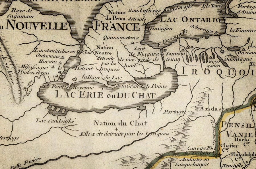
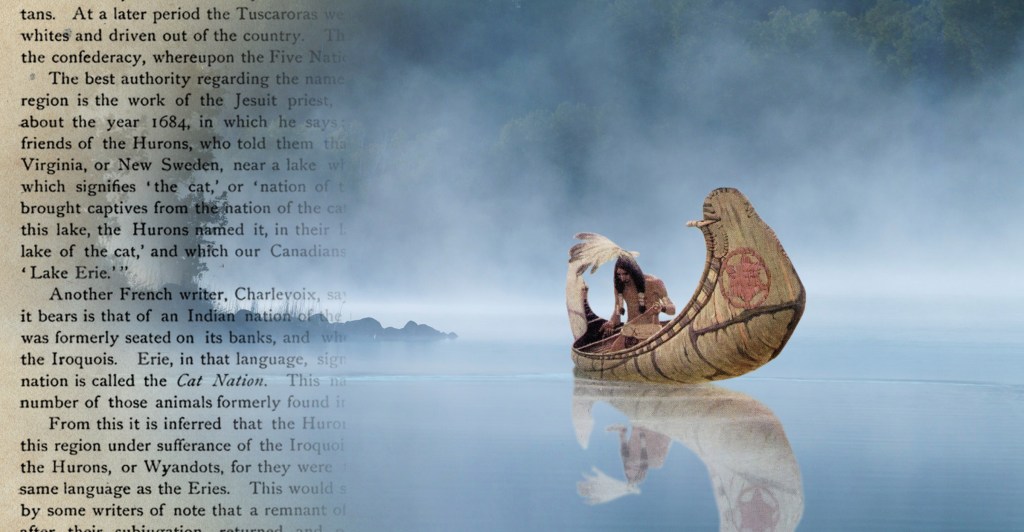
It is well established in the National Story, that in the early years of colonial America there was a distinct tribal group known as the Erie, who left their name behind on the Great Lake fifty miles north of Mansfield. The Erie villages and clans are documented along the southern coast of Lake Erie in New York, Pennsylvania and Ohio; but we have no direct records of them because they were completely wiped out before 1656 when the first French missionaries came to the Erie shores.
The story goes that the Eries were not simply wiped out, but that they were actually hunted down to the last soul, and meticulously eliminated one by one until there were none of them left.
Traditions vary as to how, exactly, they annoyed the Iroquois so profoundly that their angry brothers undertook the arduous detail of seeking out and killing every last one of them. That part of the equation is ephemeral, variable, hearsay, inadmissible in court. The part that is more concrete are the bones.
Possibly:
During the dangerous decades of purging and holocaust, when the Eries were running for their lives, it does not seem the least unlikely that a band of fugitives made it as far as Richland County before they were overtaken and slaughtered. The evidence here could support that theory.
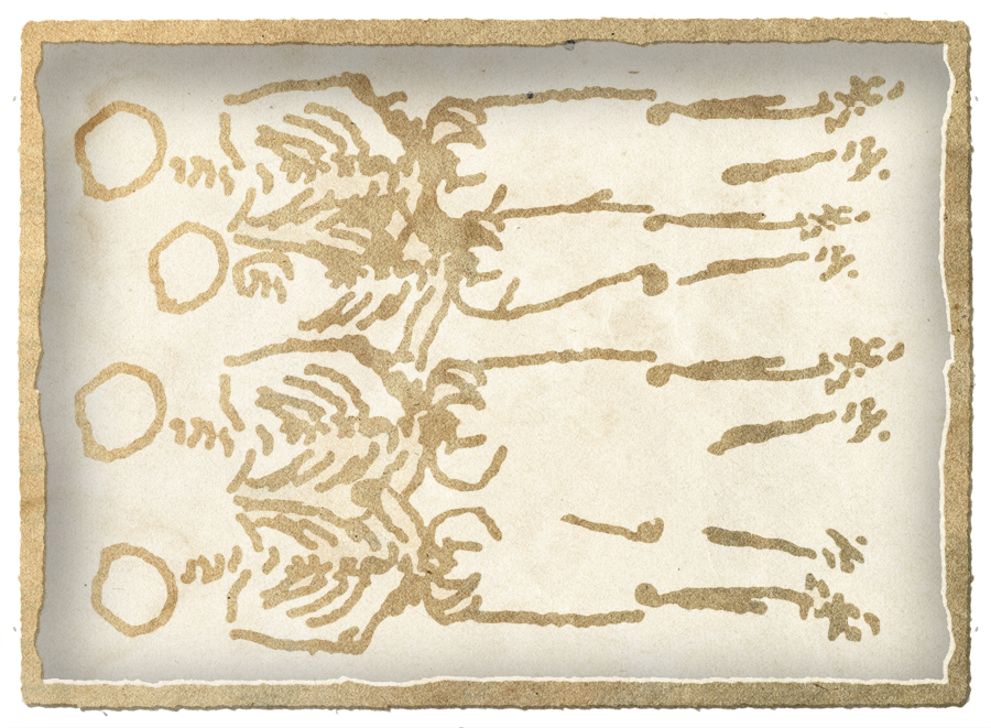
The evidence was dug up in Pleasant Valley in 1939 by a contractor with earthmoving equipment, who was digging a pond at Malabar Farm. He turned up some bones and, not wanting to disturb the scene of a crime, he turned off the motor and proceeded more carefully in the dig with shovels and trowels.

He and his colleagues unearthed four skeletons lying side by side, shoulder to shoulder. By the depth of the dirt and condition of the soil and roots, it was clear that the four bodies presented a crime that well predated American history.
Prehistoric bones were not an uncommon find when digging pits and wells and outhouse holes in this part of Ohio; but there was one striking feature of these particular skeletons that made for intriguing speculation: each of the four skulls was clearly smashed with a heavy object, like a tomahawk.
Each of these men was executed—maybe by angry Iroquois hunters; possibly creating an Erie gravesite in Richland County.
2) Verifiably So:
Back in the distant past, thousands of years ago when the last glaciers were melting away and receding; when the first paleo people were wandering into Richland County to see what the ice had left behind; there was a shallow lake of meltwater that pooled so its shores ran through the northwestern quadrant of the county.
In recent epochs, American geologists have given this large body of water the name Lake Shelby—mostly because the City of Shelby is situated on a land bridge in the middle of that ancient lake. Clearly the lake was long evaporated before the Richland pioneers chose the site to build a town in 1818…but it was evidently not gone thousands of years before that when tribal fishermen camped along its shores.
We know this by the hard evidence: hand-carved fishing hooks that turned up in spring plowing for generations.
Geologists could plot out the shoreline of Richland’s ancient lake through clues of topography and soil composition; but farmers could just as easily identify the shoreline by locating seaside fishing and frog-hunting artifacts.

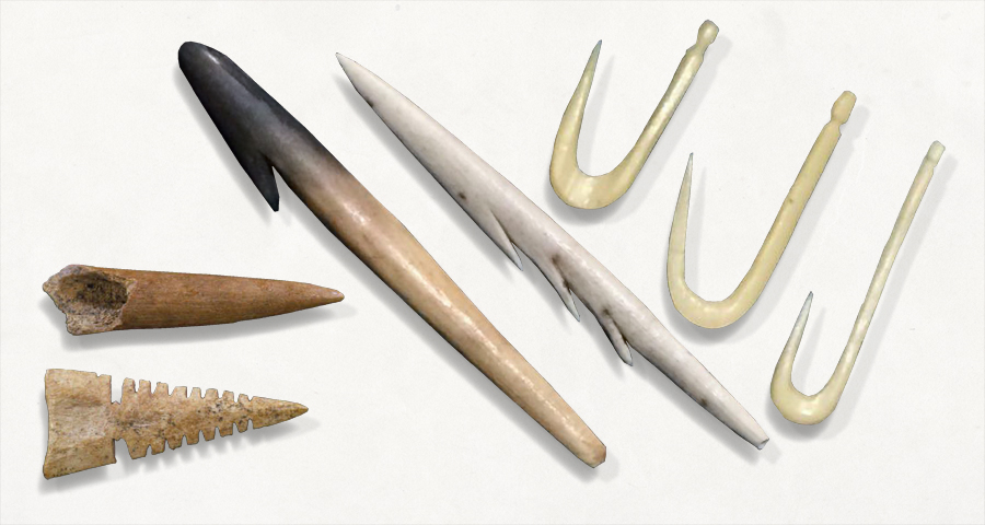
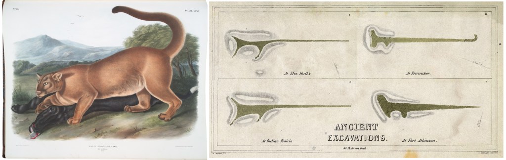
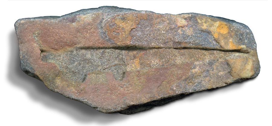
Along with prehistoric fishing equipment retrieved from Sharon and Plymouth Township dirt, one of these ancient relics is a stone plowed up in the field, that has a crude image carved into its flat side: the effigy of a panther. A big cat has little to do with fishing perhaps, but it has a lot to do with the Erie…
Maybe So:
It is not unreasonable to think that Erie people regularly traversed the hills and rivers and forests of Richland County. They could easily paddle the Forks of the Mohican to proceed anywhere south on the Muskingum; and they had access to the upper Black Fork River at a place where it passes within a short distance of the Huron River.
This portage—where river travelers could carry their canoes from the Huron to the Black Fork—had been commonly known and used for centuries…for millennia. It was drawn into the earliest maps of Ohio by soldiers and surveyors when this land was still a wilderness.
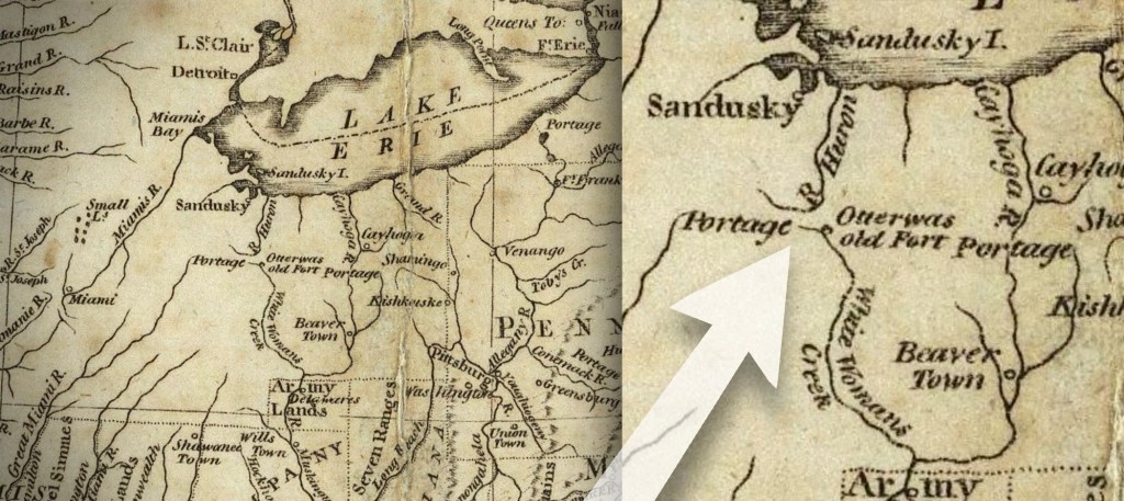
Interestingly, this ancient portage was located within shouting distance of the shores of Lake Shelby. It may possibly have passed right through the lake.
It seems unlikely that any ancient people who traveled that river thoroughfare through ancient Richland, would be unaware of scenic Lake Shelby; and it is highly probable that they regularly fished the shallows, camped the shore, gazed on the moon reflected in its waters.
One of those ancients took a rock and carved a forest cat into its surface. And this is the point: the word that became ‘Erie,’ when translated out of the ancient Iroquoian language, means ‘cat.’
It is a tribal totem.
The earliest French explorers translated our Great Lake from the natives as Lac du Chat: Lake of the Cat tribe.
From the evidence, it is easy to surmise that it was Erie folks who were summering at Lake Shelby.