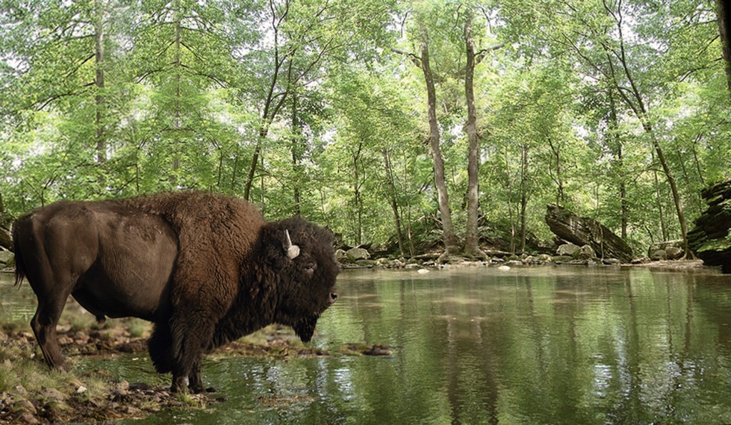
The American Bison is always considered iconic of the Wild West, but it also played an integral role in the history of the Wild East as well. If it wasn’t for the many thousands of years when the buffalo roamed through Richland County it is possible that the City of Mansfield would be situated somewhere else…because it was really the bison who picked the spot for our town.
The Wilderness
The Richland County we live in today is a very tame place compared to what it was in the past. Two hundred years ago everything here was deeply forested wilderness. If you go to the wildest place you can find in Mohican or Fowler’s Woods it is possible to imagine what this country was like before the arrival of the farming culture with European settlers, but even in the deepest, densest forest you can find there is so much native wild Richland County you’ll never see: like elk, or wolves.
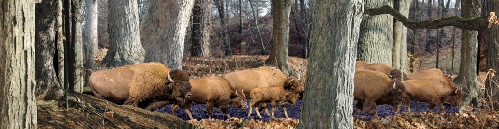
Another common woodland critter you won’t see is the bison. For thousands of years herds of bison passed through the forests of Richland County during their seasonal migrations. Just like many other creatures you may be familiar with, they liked to spend their winters down South and their summers in Ohio. For at least 12,000 years they made the trek every year from Alabama or Georgia through the primal forests up to the southern shores of Lake Erie.
The paths they trod on their travels, the routes they followed year after year, were the first interstate highway systems to cross the continent. After thousands of buffalo, each a thousand pounds, had made a thousand road trips along these forest thoroughfares, the roads they created were wide, pounded hard, and without question the easiest way to get through the dense forest once the paleo peoples got here.
When surveyors and map makers were defining the Ohio country in the early 1800s in advance of the settlers, every Indian trail they drew, every trail connecting outposts in the wilderness, was originally a bison trail.
Roadside Attractions
An American bison requires quite a great deal of roughage in his diet, and they spend 9-11 hours a day simply eating green things. One of the reasons they followed the same routes every year was because in addition to picking up forage along the way they also left behind a considerable amount of fertilizer…all of which served to grow the seeds of their favorite foods that passed through their system. So every year there were more and more of their favorite foods along the way.
Their routes tended to follow high ground between river valleys, with periodic detours into the flats for drinking and swimming parties and other forms of recreation. In Richland County this could mean literally re-creation, because the buffaloes give birth in April/May, and had their rutting season in August—either life phase of which could likely have taken place here.
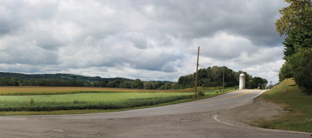
For whatever reason they decided to lay over here, it is certain their stay was longer than a quick commute, because early pioneers found a particularly bisonesque resort in the Clear Fork Valley just northwest of Butler. This was a buffalo wallow.
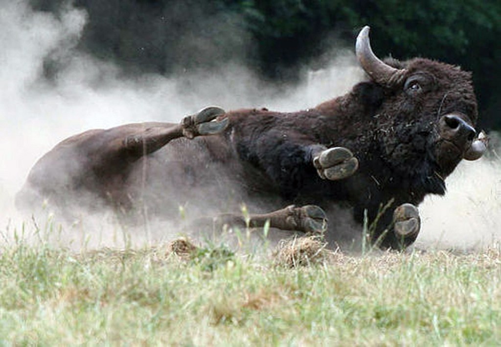
In wet moths they rolled in the mud, and in the summer heat they rolled in the dust. A bison can’t roll over because of the hump on its back, so it had to flop down on one side at a time. The dust kept off biting insects, the mud protected them from parasites. A thousand bison, weighing a thousand pounds, rolling around over a thousand years left quite an imprint on the valley floor.
Thousands of arrow heads, spear points, flint scrapers and knives also give evidence that native peoples—from the earliest paleos through the historic woodland tribes—also found the buffalo wallow to be a particularly attractive resort area.
By the time the European settlers reached this area in any significant numbers, the long season of the bison had already ended in Ohio. The vast herds of buffalo east of the Mississippi began to ebb in the 1600s, and dropped off noticeably by the late 1700s. The death of the last documented bison in Ohio took place in 1802.
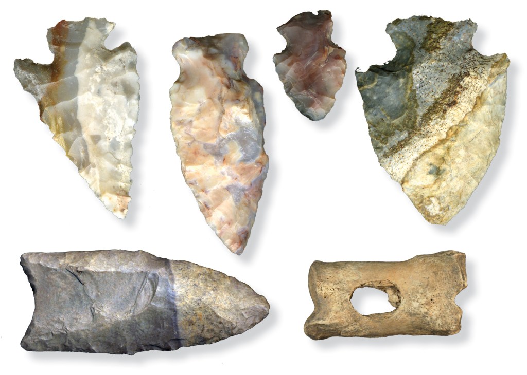
The artifact to the right is a bead or pendant made from a bison toe.
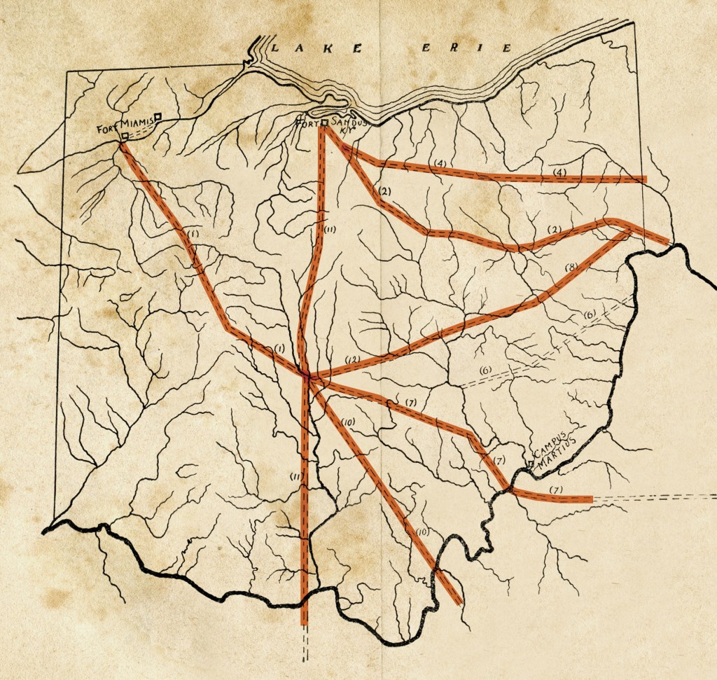
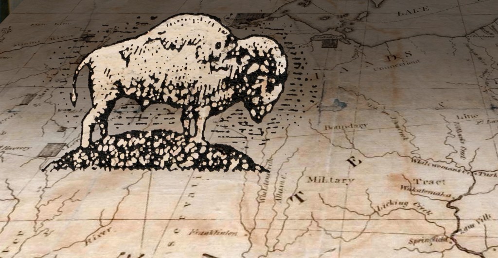
This map drawn in the 1870s of historic major tribal routes is also, therefore, a map of bison migration routes established as soon as the glacial ice left northern Ohio.
It is today State Route 603.
1807
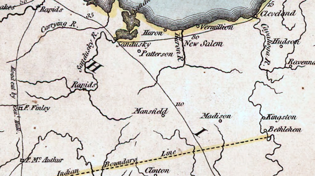
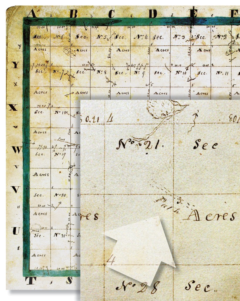
The surveyors who made their way through the wilderness in order to map out Richland County for the US government in 1807 made note on their survey maps of all the distinctive features of the landscape that they encountered along their lines.
The maps they made look like a lot of squares made by straight lines—the lines they walked with their measuring equipment—with only occasional squiggles drawn in to indicate when their line crossed a stream. Aside from those markings there is very little else drawn within the section squares because…there was nothing there except trees.
There is an unusual notation they made, however, in Madison Township, Section 22. The marking is quite obvious because of the rarity of any other such markings, showing a double dotted line with a single word. It says PATH.
How rare was it to find a PATH going through the deep woods? In all the original first surveys of old Richland County there are only 3 such notations. It had to be a bison trail—there simply weren’t any other paths. When the old survey map is superimposed on the county we know today, Section 22 is seen to cover Mansfield, and the PATH indicated on the 1807 map leads directly to a site on East Fourth Street. That is the site known in early Mansfield history as the Big Spring.
Why is Mansfield where it is? The founders said quite clearly that they chose the site because it was near the Big Spring.
How would they know the spring was there? A bison trail led them right to it.
The only paths in the dense forest were those used by tribal folk, along the trails trodden by buffalo. This one led to what was known as the Big Spring, where bison, Wyandots, and ultimately Mansfielders, came to drink.
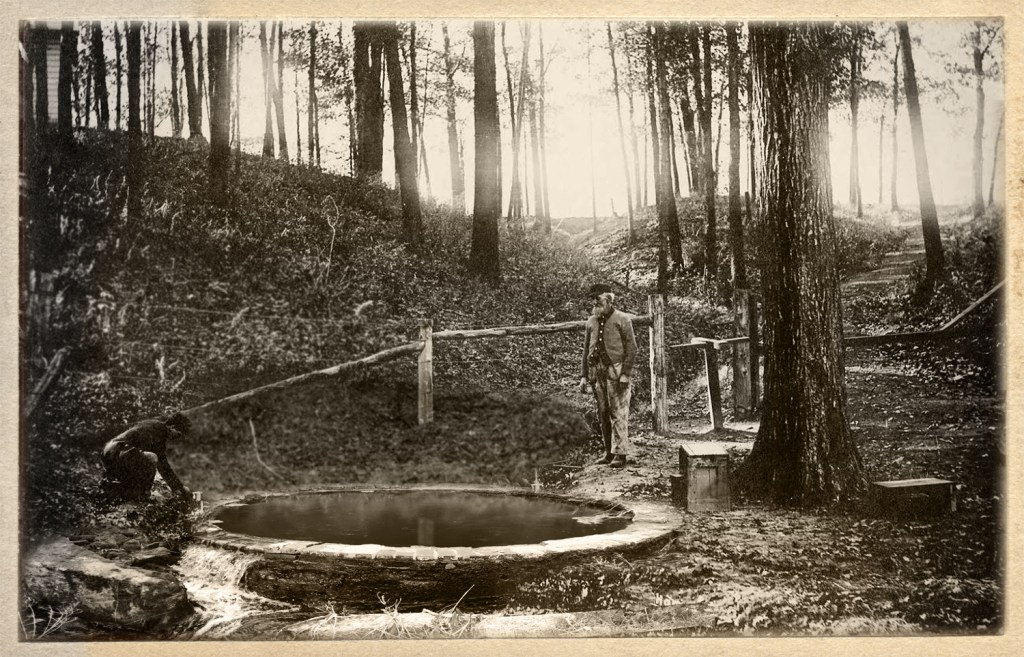
Known to bison and native tribal folk for thousands of years, the spring came out of the ground near what was to become East Fourth Street, just east of Franklin Avenue.
The photo below of the Big Spring, after it had been domesticated, was taken in the 1880s.
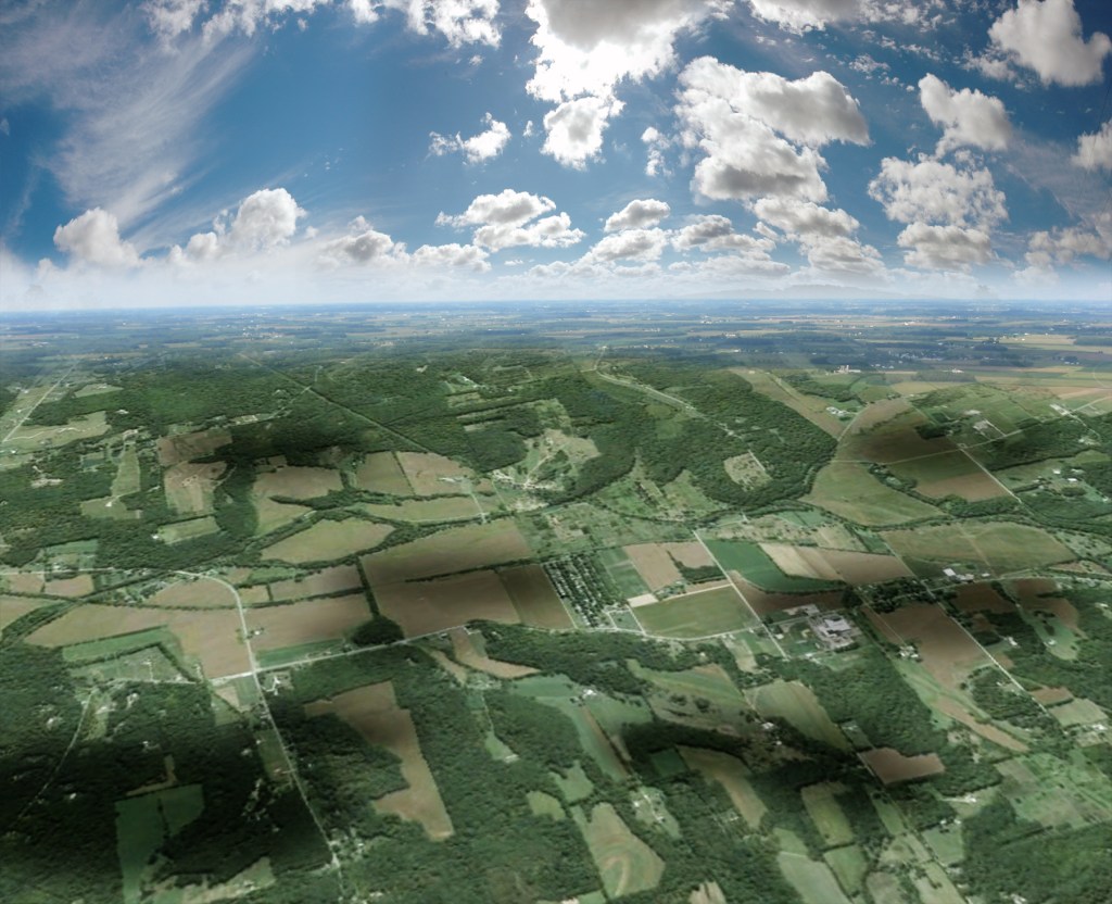
As they pass between the sun and the Earth they create a trick of light that may as well be a trick of time travel, because the sun and the clouds throw shadows that plod slowly down the valley just like ghost herds of buffalo following the Clear Fork.
