
If fate had taken a slightly divergent path long ago; if history had followed its course in the direction it was pointed without veering off another way; we would be looking at a very different map of Mansfield.
If we could escape for a moment the world we occupy today in order to glimpse an America of alternate probabilities that may well have been otherwise: then Mansfield would not be where it is today.
The Square would be over by I-71, and Main Street would be somewhere in the vicinity of Exit 173 at the Route 39 interchange.
That is where Mansfield was originally intended to be situated: on the banks of the lovely Rocky Fork River.
The whole history of Mansfield started on a little knoll that is easy to see when driving past on the highway. In fact, in this alternate reality, I-71 would be passing right through downtown Mansfield.

The Best Laid Plans
The village of Mansfield was founded as the joint endeavor of three men. One of them was James Hedges.
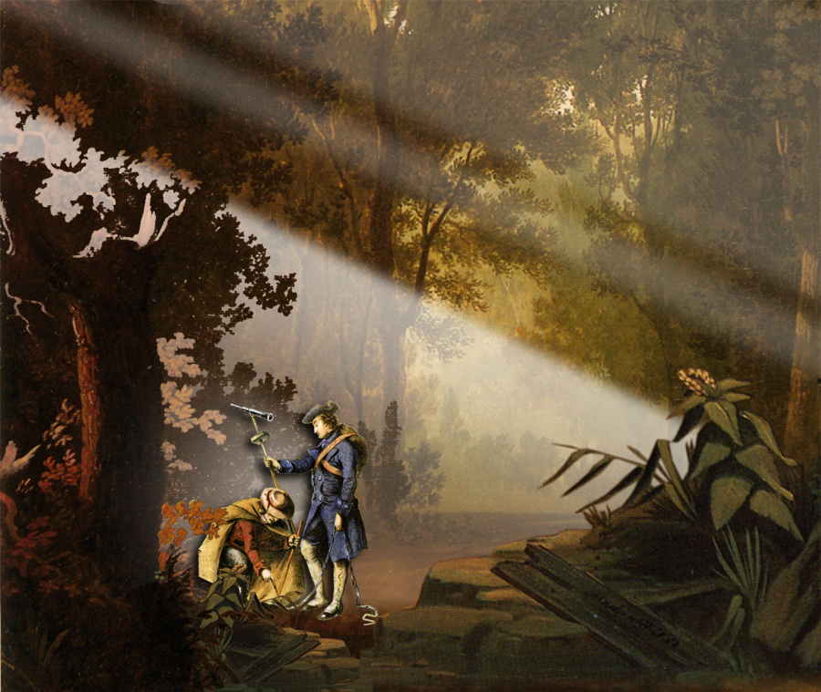
When James Hedges walked into the forest in 1806 of what would one day be Richland County, he was given the task of measuring the wilderness so it could be divided into property lines for incoming settlers.
He knew, even as he was stretching his surveyor’s chains through the woods and drawing corresponding lines in the plat book, that one day soon this landscape would fill up with farmers.
And he knew from long experience that these farmers would one day need to take their produce to town where it could be sold.
And he understood that this town would be the place where all the profits would be made, and fortunes would be amassed, and legacies would be forged.
So the whole time he was pacing off earth from tree to tree he had his eye out for where the best place would be to stake out this future town: because he wanted to be in on it from the very beginning.
Mr. Hedges had a monumental task to accomplish in surveying this part of Ohio, and it was going to keep him preoccupied for a number of months; so he contacted one of his relatives and prodded him to get out into the new land so as to be in on the ground floor of this rare opportunity.
His kinsman was named Jacob Newman.
With a few directions from Cousin Hedges, Newman packed some supplies and hiked into the woods to find the perfect place to found a town.
It was a 65-mile hike from the settlement at Canton to the banks of the Rocky Fork River, but he had little trouble locating the spot where he thought Hedges envisioned the cornerstone of a future metropolis.
The place had an interesting mix of broad plains and rolling hills: the kind of terrain that makes scenic vistas in great cities.
It had all the right kind of water: springs for drinking, and riverways for traffic, with rapids for waterpower mills.
And above all it was located close to the center of the political boundaries of what would soon be a new county in Ohio.
So Jacob Newman picked out a modest little hill where he could hear the rapids of the Rocky Fork echoing up through the trees, and he built the first settler’s cabin in Richland County.


Hard Reality
It was the spring of 1807 when Jacob Newman set roots at the Rocky Fork, and he had a whole year to try out the place before his kinsman Hedges would arrive to officially draw up the new village.
That was a year of hard work and hard lessons.
Newman had no problem with heavy labor: cutting timber and stacking log cabins was a big undertaking for 4 men and one woman, but he had that under control.
His problem was with the little things he had no control over.
Those little things were mosquitos.
If Jacob Newman would have had the benefit of studying the surveyor’s maps that Hedges was making, he may have considered finding an alternate site right from the start.

Revision
So, in the spring of 1808 the three founders set out from Jacob Newman’s cabin into the woods along the Rock Fork to see if they could find a place upstream for their town that was not already settled by mosquitos.
It was about two and a half miles upstream where they found some high ground, free of mosquito swamps, that had a great view. There was a big spring nearby, so they went to the top of that rise and paced off the Square. That was where Mansfield was repositioned on the map, and where it is today.
The Newman Cabin
The site where Jacob Newman originally planned to place the city of Mansfield is pretty obscure today, but in its time it became an important center of activity.
There was a blockhouse there during the War of 1812, and it was subsequently the site of an important gristmill for generations.
Newman built a sawmill there, powered by the Rocky Fork, which meant that when he expanded his cabin the new wing had a real floor.
He didn’t stay there long however. As soon as it became clear that the alternate Mansfield 2.5 miles away was going to catch on, he packed up and moved into town on South Main Street.
Jacob didn’t live long after that. His legacy lived on inside Mansfield city limits, but through time his old original homestead lapsed from public memory.
The cabin served for a number of generations as a home for the families who operated the nearby milling business, but once the mill era passed the old log place was simply rented to a sequence of tenants.
The last folks to live in Jacob Newman’s cabin moved out in the 1950s, and the old place was removed without a thought.
When Newman came to Richland County he built his cabin on an unnamed knoll by the side of an Indian trail. Today that site is found at the corner of State Route 39 and Sites Road.

Underneath the siding “the house was a log cabin made up of two parts.”
“About 1952 the Welty family moved out, and in 1953 the land was sold and the house torn down.”
(Alan Wigton, The Newman Cabin, 2001.)
