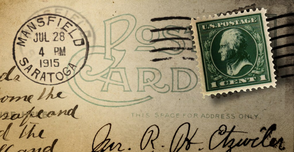
If Thomas Jefferson had his way in 1784, Richland County would not be in the State of Ohio. Our address would be Mansfield, Saratoga 44901. The county line would border on two other U.S. states: to the east would be the State of Washington; and to the north—just across Main Street in Plymouth—would be the State of Metropotamia.
What?!
For a little background please open your American History textbook to Chapter 1. We like to think that the United States of America was born on the Fourth of July in 1776, but in truth that was the date that set in motion the labor pains preceding the actual birth. The U.S. wasn’t really born until the last inning of the Revolutionary War was played out, the fat lady sang, and the British let go of the Colonies. That was in 1781.
Nearly two years later, the Treaty of Paris tidied up all the details, and in the reading of the will it turned out that the U.S. inherited all of the unsettled British territories west of the Alleghenies. That was in 1783, so right away the Founding Fathers started imagining how they might go about appending all that New World to the left side of the original 13 United States.
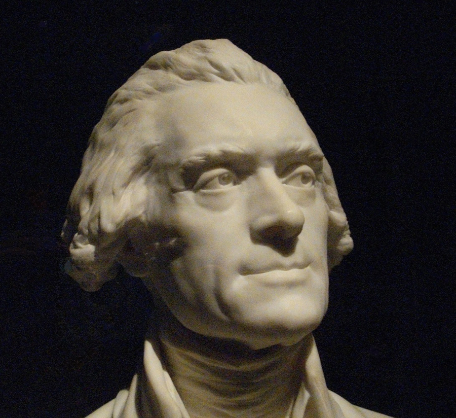
There was a committee formed in Congress to put together a few ideas, and Thomas Jefferson eagerly took charge. Within a few days he had it all divided up in his head, and when he was drawing them out on a map he couldn’t help but start naming the states like a newly hatched basket of puppies.
What’s In A Name
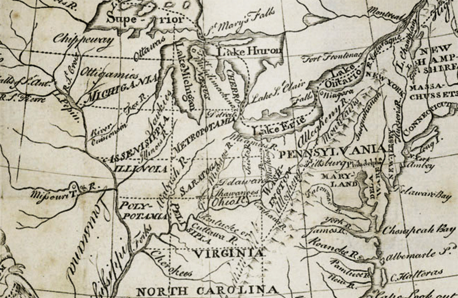
The vast area between the Ohio River and the Mississippi was all up for grabs, and Jefferson drew what seemed to him to be the most logical boundaries creating 10 states (where there are today 7—from Kentucky to Minnesota.)
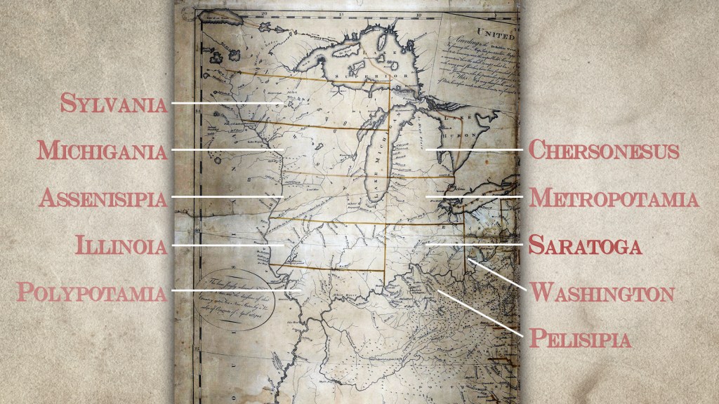
Sometimes his names were simply Old World language: like the state of Chersonesus (Michigan) which is simply Greek for ‘peninsula.’
Admittedly the region already had a few identity issues. The mountainous area that is today West Virginia was known then on all the maps as Indiana…because it was full of Indians.
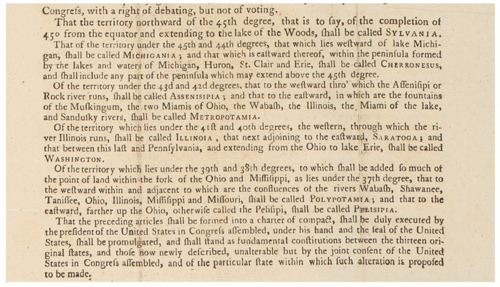
No one could even be sure what the Ohio River was called because only a relatively small portion of the population had heard of it, and they knew it by many names according to whose map they were looking at. French maps called it Long Reach River, or sometimes Belle R. Jefferson, for some reason, called it Pelisipia, and insisted that the term Ohio was some sort of derogatory hillbilly nickname.
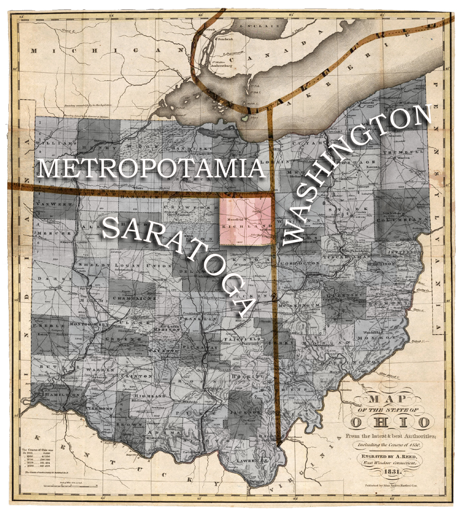
If the Ordinance of 1784 had passed Congress in its original state as imagined by Thomas Jefferson, we would be in the State of Saratoga and half of Plymouth would be in the State of Metropotamia.
Our Neighbors to the East
The name for the State of Washington, which was comprised of all the Ohio counties east of us to the Pennsylvania border, made sense in a way because George himself had actually been there, explored and surveyed segments of it, and owned a considerable chunk of it. At that time—in 1784, when this map was composed—he was considered the Hero of America for his role in conducting the Revolutionary War, so it was appropriate enough to name a state after him. He had not yet been President. The office of the President wasn’t even established until 1787 when the Constitution was put together. That’s how early this story takes place.
It was so early in our history, in fact, that the newly liberated folks were still calling it the Confederated States of America. Congress had no capitol, and they were holding their hearings in a sequence of venues wherever it seemed convenient, in PA, NJ, MD, NY. When this particular 1784 committee convened, Congress of the Confederation was in the Maryland State House in Annapolis.
In Committee Assembled
The committee who put together the preliminary Ordinance of 1784 drew their boundaries according to latitude, longitude, and picturesque features of the Ohio River like the Great Falls at Louisville. The boundary between Saratoga and Washington also happened to delineate the east coast of Richland County as it was originally designed. That line ran from ‘the cape of the Kanawha River (near Galipolis) due north to Lake Erie.’
The committee went along with naming the states, and adopted the fanciful and pseudo-classical names that Jefferson dreamed up. These were: Sylvania, Michigania, Cheronesus, Assenisippis, Metropotamia, Illinoia, Saratoga, Washington, Polypotamia, and Pelipsia.

Saratoga
Fortunately for us, and most fortunately for folks from Toledo who would otherwise today be known as Metropotamians, when Congress passed the Ordinance of 1784 they struck out all the parts that included Thomas Jefferson’s creative names for states.
It might not have been so bad for us here had Jefferson’s plan survived. Saratoga, as a name, is kind of pretty—certainly dignified and steeped in honor from the Revolutionary War battles that took place in Saratoga NY that were big victories for the U.S. army.
The word is said to derive from the Mohawk language: Se-rach-ta-gue meaning something like ‘hillside country of the quiet river.’ Sounds like it might actually describe Richland County.