Just like the path of the sun and the moon and all the planets, the principal route into Mansfield is from the east.
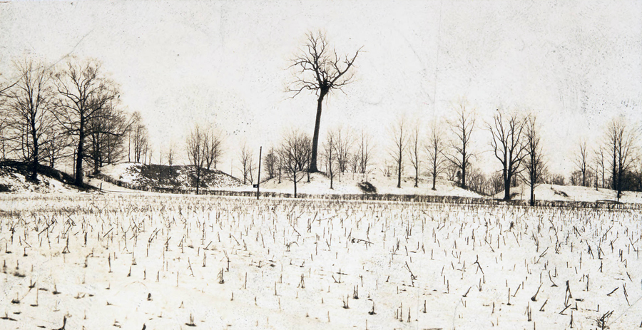
If you have entered from the east on US Route 30 you know this thoroughfare has the most commanding view of the city; in fact, if the guardians of the city were to choose a seat on high from which to watch our town it would be on that eastern rim of the valley high above the Rocky Fork, on the sandstone mount with the best overlook.
Two thousand years ago the people who lived around Mansfield clearly felt the same way.
That’s where they placed their sacred circle from which to watch the planets circle the earth of our town.

Ancient Earthworks in Mansfield
When the pioneers came to Richland County it was apparent to them they were not the first wave of settlers to choose these hills upon which to build their civilization.
There were already structures and edifices here when they arrived, constructed of mounded dirt: some of them quite monumentally and artfully designed.
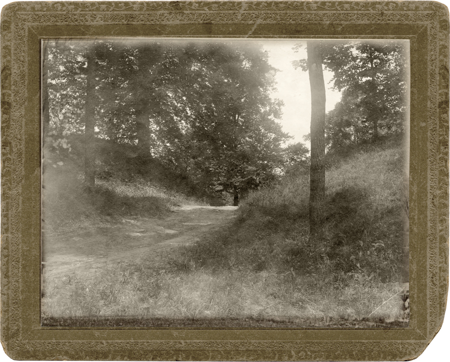
The mounds had trees growing on them: huge trees that were hundreds of years old.
Scientists of the 19th century had no context in which to place the ancient earthworks: the weird landmarks defied all frame of reference in the known history of the known world, and presented only baffling questions.
Information about the “mound builders” during the early 1800s was purely speculative, and theories of who they might have been ran a wide spectrum of fantastic notions from Biblical giant Nephilim to the Lost Tribes of Israel.
All scientists and historians could do at that point of the timeline was to document their findings.
The Records
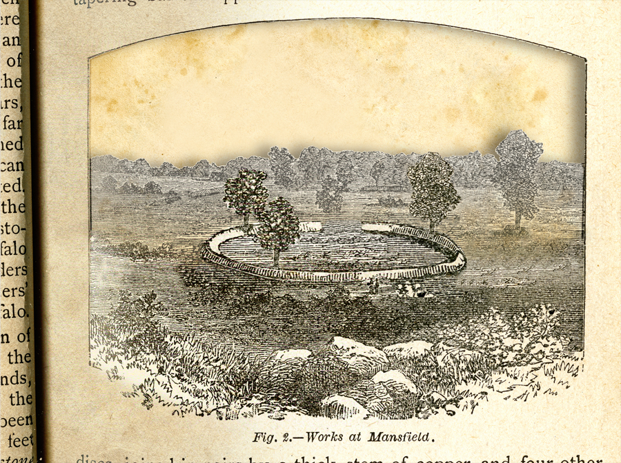
The first description of the Mansfield mound complex was published in the Mansfield Herald in the 1850s.
Witnesses described, “a well defined oval embankment with aged oaks growing thereon; 594 feet long, 238 feet wide, containing two and two-thirds acres.”
They also made note of “a series of depressions, arranged geometrically, of various widths and depths; some of which are four feet in depth, and some ten to twenty feet in diameter.”
In 1879 the County Surveyor investigated the site, which was referred to at that time as ‘the principal earthwork in Richland County.” A couple holes were dug to the depth of eight feet, but they turned up nothing striking, so interest lapsed for another generation.

Further Study
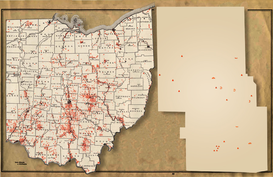
The next documentation came in 1914 when the Ohio State Archeological and Historical Society published an Archeological Atlas of Ohio with maps of every county, locating all the known ‘Prehistoric Remains in the State.’
The map of Richland County in the Atlas is not overly accurate in its placement of symbols representing mounds, enclosures, village sites and burials; the but field notes of its surveyor add one intriguing detail to the record of Mansfield’s ancient landmark.
The staff member of the Ohio State Museum who was sent to Mansfield to verify our site casually observed that the 8-foot-tall oval enclosure displayed periodic ‘notches’ in its height: creating intentional breaks in the surface.
He also noted a full break in the wall for a roadway, located on the southwest side of the structure.

The Last Sighting
In the end of the 20th century archeologists assumed that the Mansfield mound complex had been destroyed by construction of the US Route 30 bypass north of town in the 1950s.
The last person who commented about the landmark however, was looking at it after the highway had already been laid across the landscape.
Writing in 1957 Lloyd Barr of Kingwood Center thought the earthworks were intended as an ancient defensive fort, though he said, “There is little to suggest the fortifications today.”
At that point in history the earthworks were still apparent enough on the surface of the ground that he was able to observe the outlying circular depressions situated around the outside of the oval enclosure.
The were arranged, “in a pattern that suggests geometric precision of design.”
Cosmic Ancients
Most of the information about Mansfield’s ancient mound works was recorded before anthropologists had begun to have much comprehensive understanding about the Hopewell culture of prehistoric society; and all of the documentation was done before the advent of a new field of scientific inquiry presently called Archaeoastronomy.
The people who lived in our part of the continent during the epoch of 200 BC–400 AD have come to be designated as the Hopewell. They left behind a great many earthworks that have certain geometric characteristics in common: aligning the structures so as to point at significant risings and settings of the sun, moon and planets.
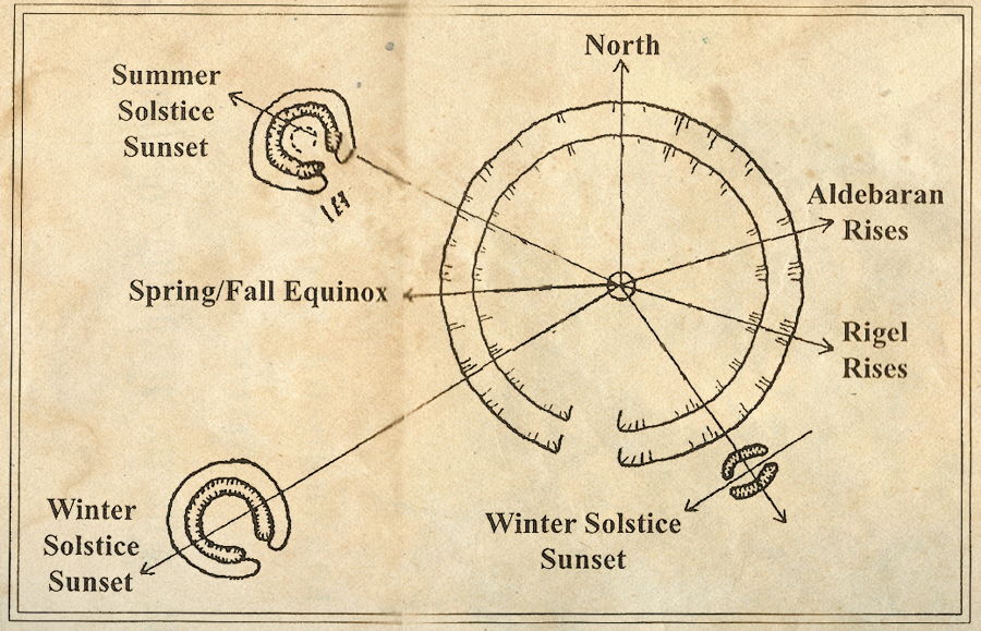
With a key of where to stand in the mound it is possible to sight through indicative notches in order to see exactly where on the earth’s horizon the sun will rise on its solstice; where the moon will rise at the apogee of its 18 year cycle; where Venus can be found when it is time to start the planting season.
A spectacular example of this astronomic earth construction can be seen only 50 miles south of here at the Great Circle Earthworks in Newark, which was apparently the epicenter of Hopewell astronomical technology.
There is every reason to expect that the Mansfield ancient earthwork could have similarly served as a seasonal observatory.
We know it was oriented in an astronomically suitable east-west layout; that it had a variety of calibrated indicators, which could have created sightlines of astrological consequence.
Locating the Observatory
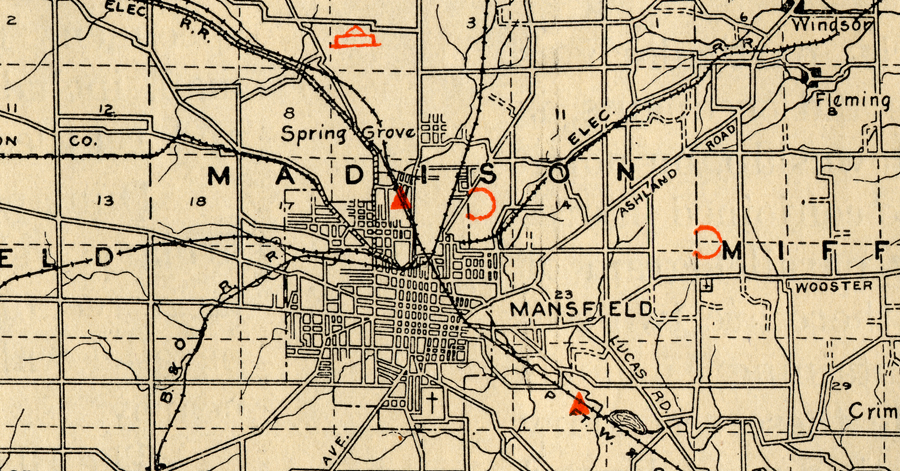
All of the 19th century descriptions of the Mansfield ancient earthworks were vague about its precise location. It was located “about one-half mile northeast of the city of Mansfield.” The Archeological Atlas map is similarly non-specifically inaccurate.
The best directions came from Lloyd Barr in 1957 when he said it was “just north of Coolridge Golf Course.”
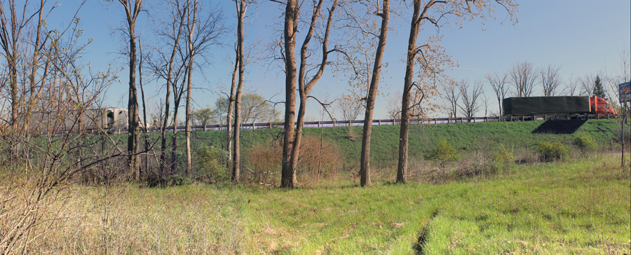
The site today is somewhere in the vicinity of the Eastbrook Center banquet hall. Part of the acreage is developed, and part of it is rough and overgrown. There are a few tantalizing curved rising ridges but it would be difficult to say if they were ancient walls or 20th century piles of bulldozed scrap fill.

Then & Now
No one knows today what cultural significance the embankment circles had for the Hopewell people, but they obviously had great power for them because it took a tremendous amount of effort to create the mounds. And they served a community that lasted many centuries longer than our nation has been in existence.
It would be quite a stretch of imagination to wonder just what it was like to be in Mansfield 2000 years ago when the celestial observatory was new.
But how much more astonishing would it be for those folks if they experienced a momentary time warp that let them stand in their sacred circle today in our time: to hear the continuous tumult of traffic just a few yards to the north, sounding like an unceasing roar of wave after wave in the ocean of time.