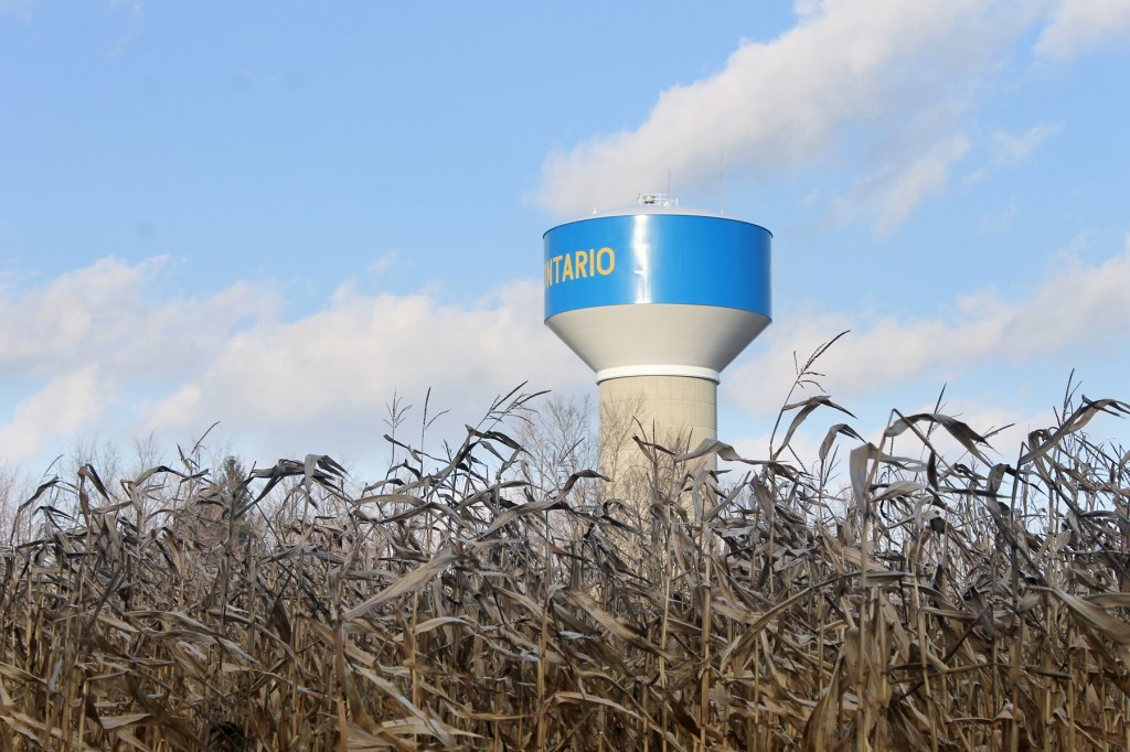
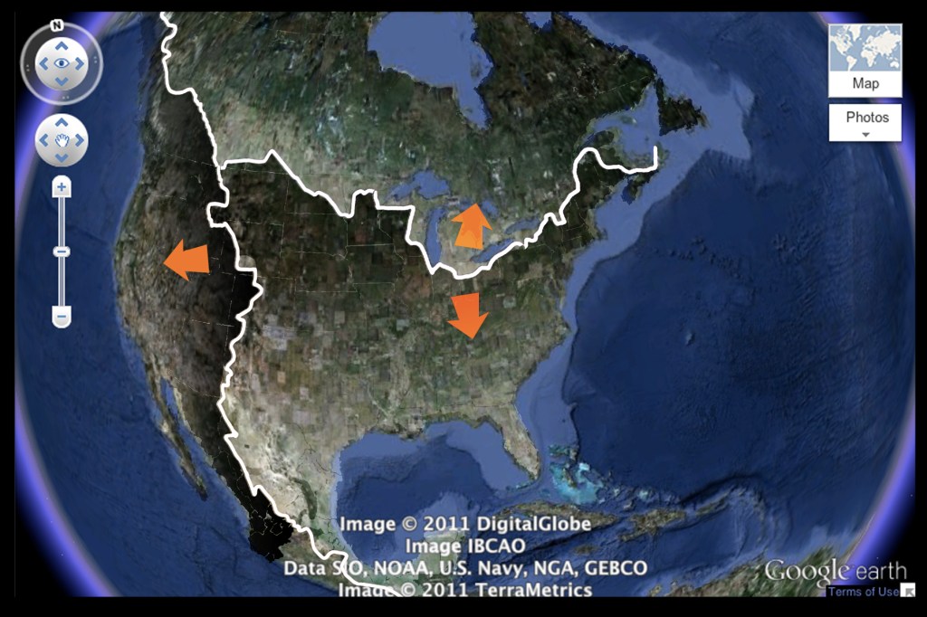
Here we are at the top of the world. It is not the highest point by far, but it is definitely the breaking point, where Richland County sits atop and straddles the Continental Divide. That means all the rain that lands here goes either north to Lake Erie and the Saint Lawrence Seaway, or it goes south to the Gulf of Mexico.
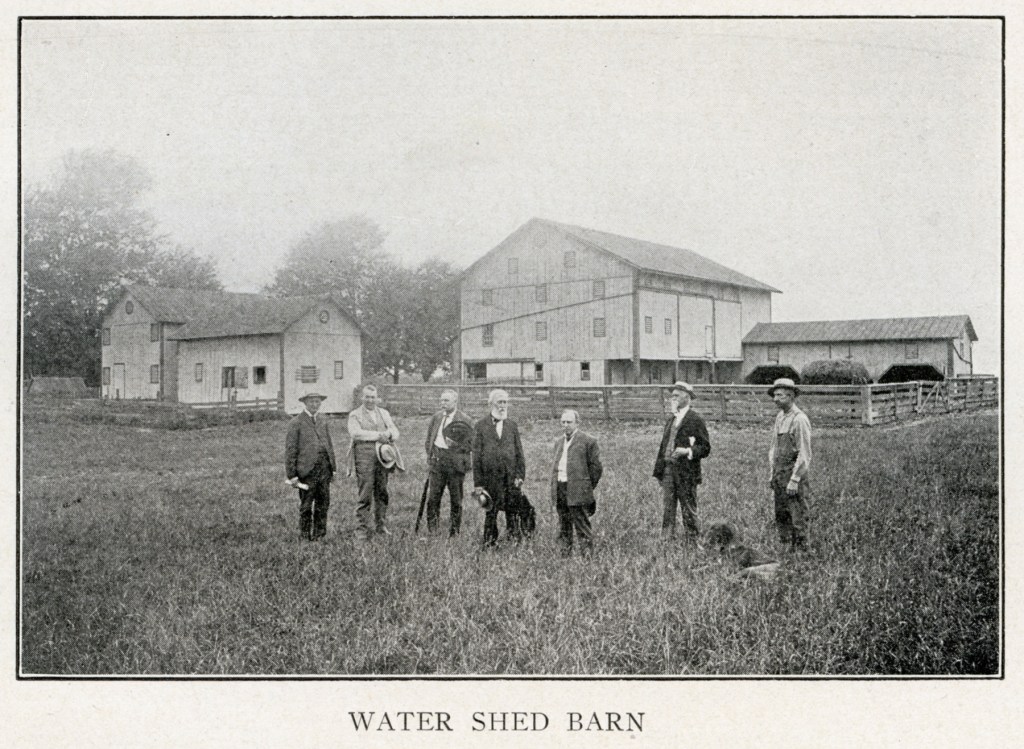
There actually used to be a barn halfway between Ontario and Crestline whose peaked roof divided the rains to one side of the continent or the other. It was called the Watershed Barn, and nearby, in close proximity, are two small but significant spring-fed lakes. One of them, on the northern side of the Divide, provides drinking water to the Village of Crestline; and the other lake, on the south side of the Divide, is singularly responsible for the origin of two different rivers.

Five Ohio Rivers
When rain falls within the boundaries of Richland County it channels to five separate, distinctly different river systems. We tend to be particularly identified with the Mohican River and its forks, but our streams also feed the Sandusky, the Huron/Vermillion, the Walhonding, and the Scioto.
The Walhonding picks up water from the southernmost part of the county, and connects with the Mohican east of Mt. Vernon. The Scioto also heads south, but its Richland waters don’t comingle with those of the Mohican until both waterways have dumped into the Ohio.
The Huron/Vermillion goes to Lake Erie by a route out of the northeast corner of the county, and the other north-flowing river—the Sandusky—trends more westerly out of Richland before turning north to Sandusky Bay.
Two Forks
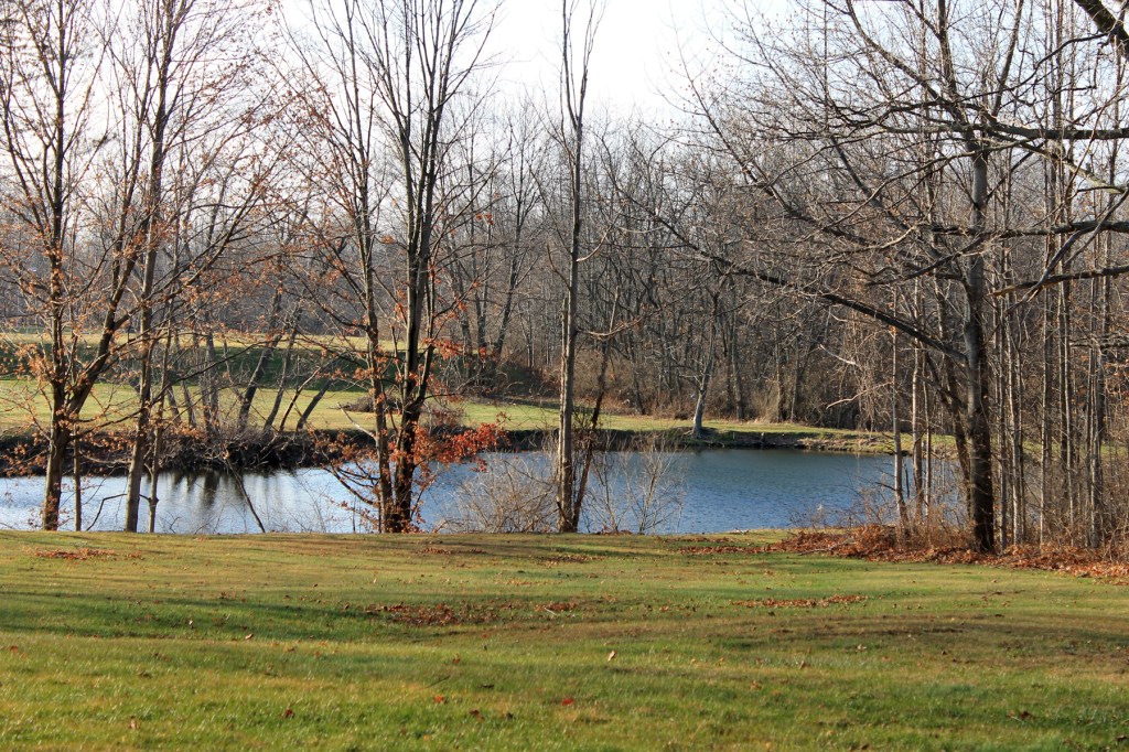
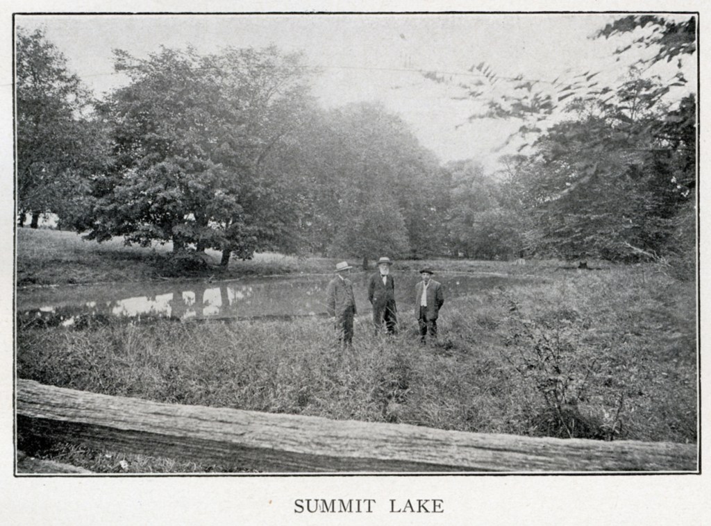
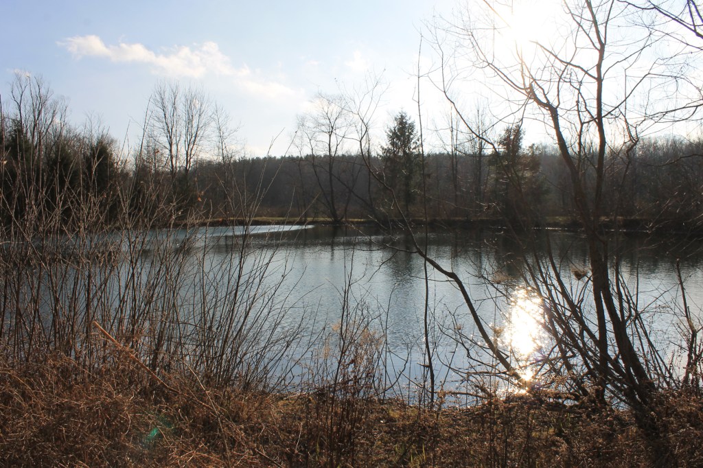
What is really fascinating to a Richland river hound is one particular body of water that was known in 1903 as the Summit Lake. From this one little spring-fed pond in Springfield Township come two streams that run off in two different directions as the fount and origin of two separate Richland County waterways: the Black Fork and the Clear Fork.
One creek bed travels south as the headwaters of the Clear Fork River—flowing through the southern end of the county. The other little creek strikes out north toward Shelby and gains enough support from other brooks and tributaries to become the Black Fork, curving up through the northern end of the county.
If you were to drop two leaves into the Summit Lake—one at each end—so that they each went boating off in different directions, these two leaves wouldn’t meet again until the rivers join at Mohican State Park…a combined journey of nearly 100 miles.
The Watershed Barn
It appears that 1903 was the high water mark for the Watershed barn. That year, for some reason, the romantic notion of a single turning point in the forces of nature took hold of the public imagination, and people came from all over the state to see and photograph our remarkable landmark barn.
At that time there was a streetcar from Mansfield to Crestline that passed close enough to the hill so people could jump off and stroll to the site. There was even a little picnic grounds that took root nearby to accommodate tourists.
A woman from Parma, Ohio, Mrs. Lottie Fludd, traveled here in 1903 equipped with two glass vials so she could collect water from the eaves of both sides of the barn to show her Women’s Club.
The Continental Highway
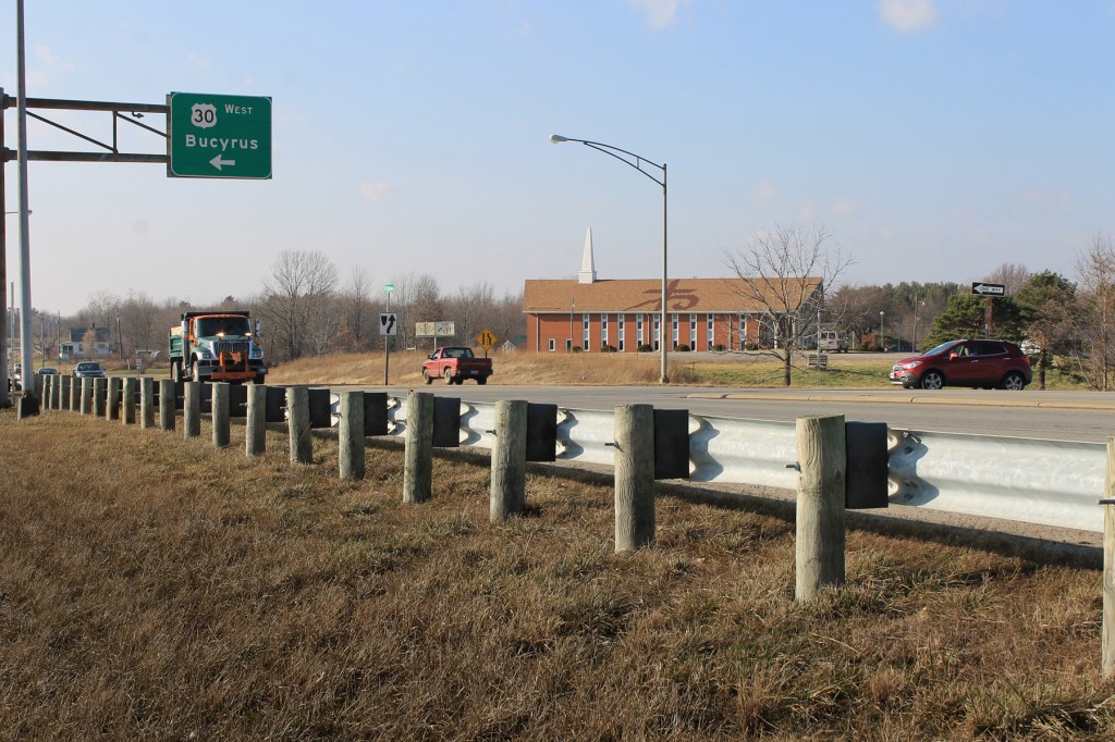
The public fascination didn’t last long—within a generation most everybody had forgotten all about the barn and its significance. By the 1950s, when US Route 30 was leveling out the landscape to make room for four lanes of traffic, the barn was demolished without a second thought, and the nearby landscape was entirely re-configured for exit ramps.
Today the approximate location of the Watershed Barn can be identified by a familiar landmark on the way to Crestline: at the junction where, for many decades, the four-lane pavement ended. It is a hilltop church building formerly occupied by a Grace Brethren congregation, today home of Hesed Agape Ministries from Mansfield.
Superimposing Past and Present
The havoc wrought by Time, in partnership with our ever-recreative American society, has a way of erasing the maps of former times and re-drawing them in new patterns that leave few reminders of what has gone before. Today the streaming traffic of coast-to-coast motors on Route 30, and its busy clover-leaf interchanges, leave little to suggest that those 16-wheels are passing a point of history and gravity at West Fourth Street: where the North American continent stops ascending into the sky and starts the long trip back down to sea level.