Easter came early in 1913, so did the April showers. Easter fell on March 23, and the sky fell shortly thereafter. Within a week of Easter the weather was being called Our National Calamity.
The storm system officially mounted out west, and came onstage in a big way with a fanfare of tornados in Nebraska, Iowa, Indiana on its way to Ohio. By the time it reached Richland County it was carrying less wind, much more rain.
The first drops fell here late Sunday night, March 23, and on Monday at about 4 PM the clouds just dumped. Once the deluge began it came with full force, and it didn’t even slow down until Tuesday. Then there was a break long enough to go take pictures.

The Weather Report
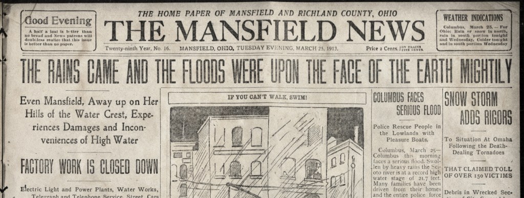
When the Pennsylvania Railroad later published their records of the massive destruction they had suffered, the documentation included weather maps of the U.S. showing the highest rainfall in the nation right on top of Richland County: at least 10 inches. Most of that volume fell within a span of 12 hours, though it rained for four days…and snowed a little bit too.
From the moment it started everyone here knew they were experiencing something epic and historic, and the Mansfield News would say even Biblical.
The main fear factor involved was that the mighty wave struck in the middle of the night. In Mansfield the power went out pretty quickly because the generators were in the Flats, which had three feet of water right away. By morning the city’s water service was cut off as well.
In the pitch dark, with the roar of water falling from the sky and racing ever higher through the streets, folks in peril had only one way to sound their alarm: by firing off guns from the upper windows and rooftops of their inundated homes.
The Show
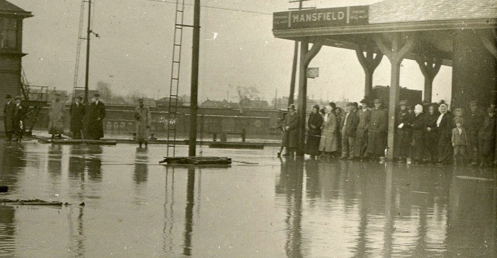
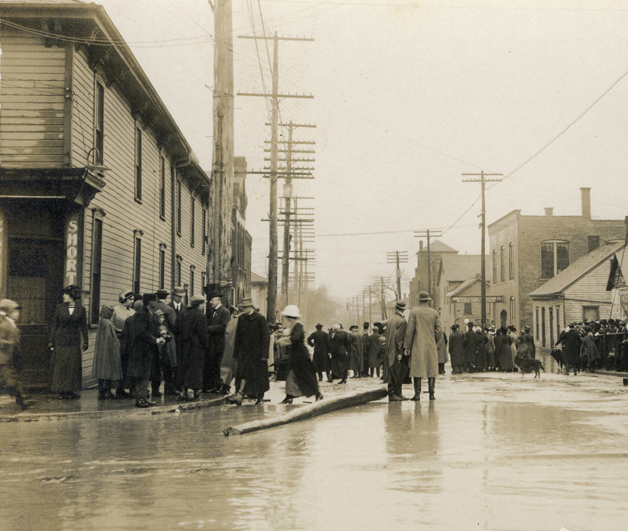
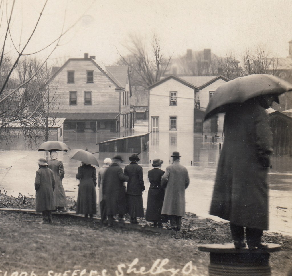
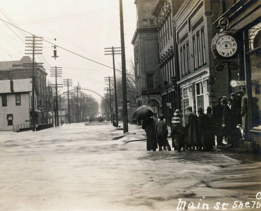
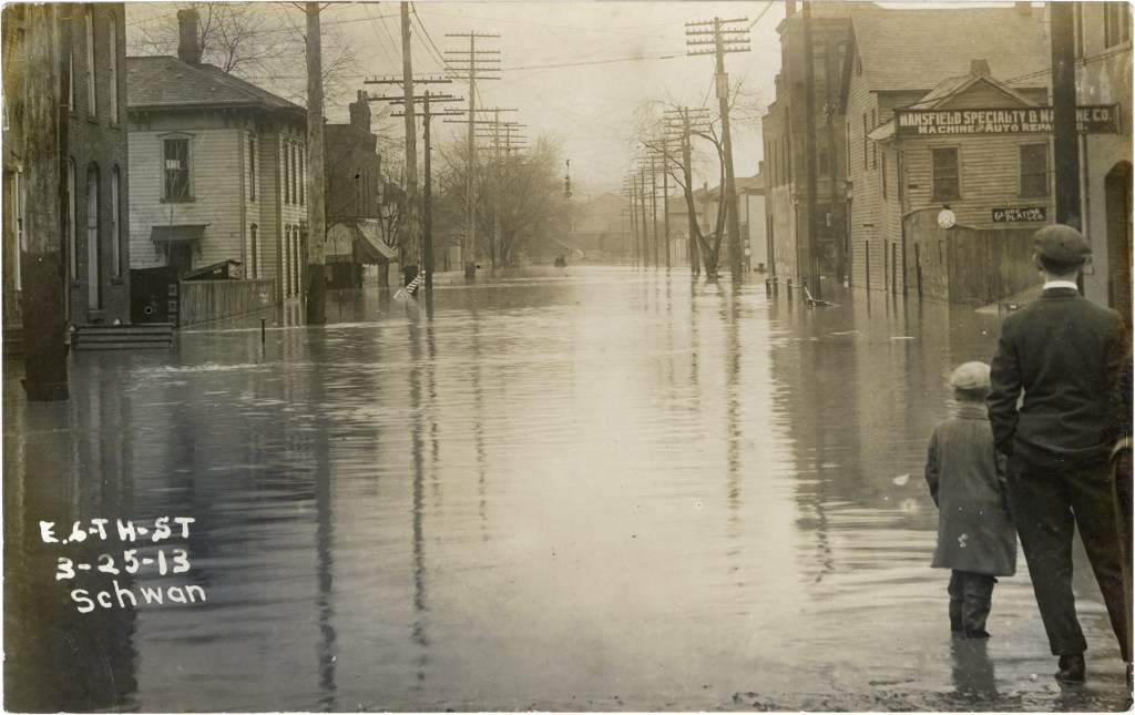
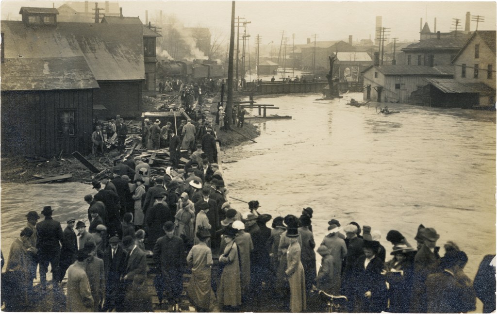
Disaster is always a popular spectator sport, and as soon as it was light out and the rain had ebbed a little, everyone walked to the downtown of their community to watch the rivers gobble up the streets and swipe their bridges.

On the north end of Bellville, Lottie Rhodes bundled up her kids and went out to witness the Clear Fork making history. They found a hill well above the wash and sat down to watch the parade. Everything floated past them: outhouses, picket fences, barrels, furniture. What they never forgot, and spoke of 60 years later, was a huge sycamore tree boating past in the waves, and in its upper limbs sat a whole flock of chickens that managed to hop aboard for the ride.
The Runoff
Fortunately for us, Richland County rides high atop the continent, straddling the tallest earth in Ohio, so the overwhelmed Clear Fork, Black Fork & Rocky Fork soon passed the torrents on downhill to worry folks in the lower altitudes. Compared to cities downstream where death and destruction was truly horrifying, Richland’s towns and villages got off relatively easily with only one life lost to the waters.
One human life, that is; chickens are another story.

SHELBY

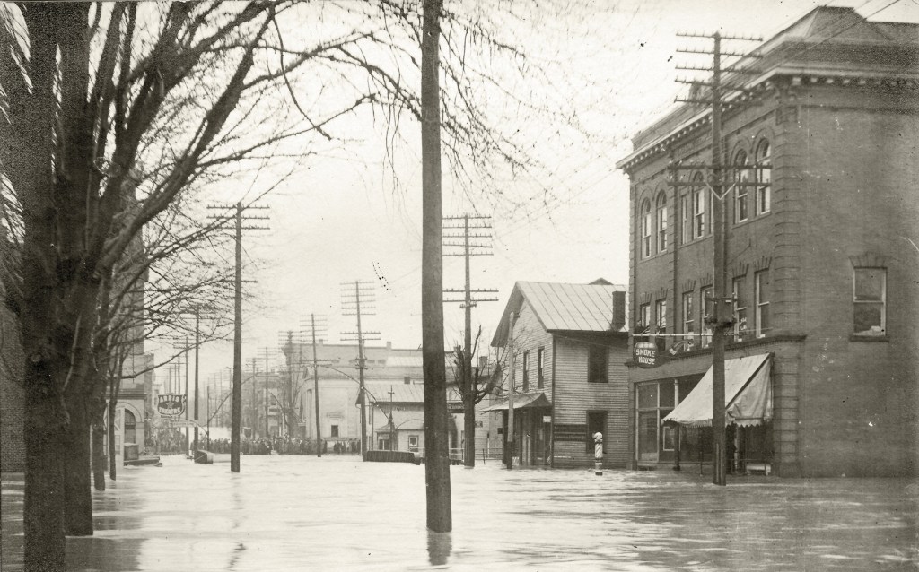

MANSFIELD


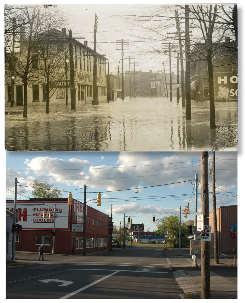
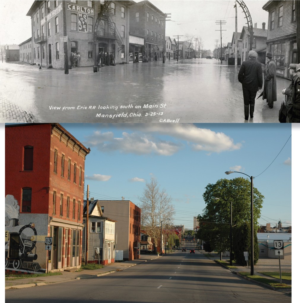
This part of Mansfield was known in the 1800s as Frogtown because the flats around the Rock Fork were seasonal swamps.
LEXINGTON

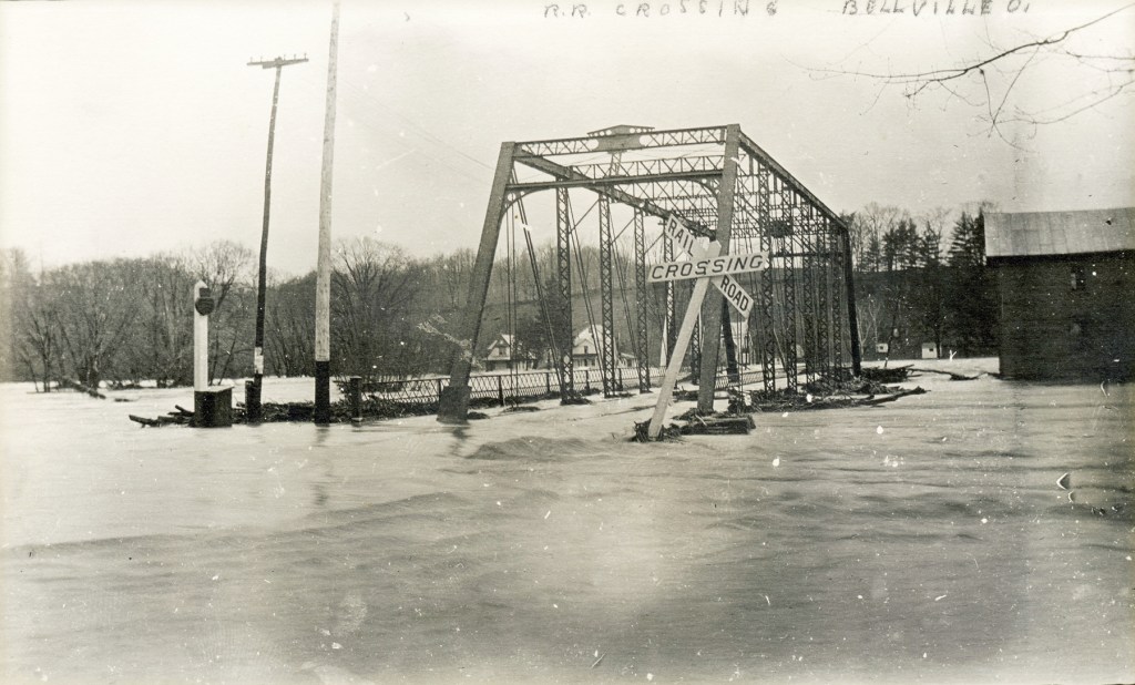
BELLVILLE


BUTLER

