The Law of Time
This is the law of time: for every hour we go on there is an hour that slips behind, so that for every bit of gain there is equal loss. In order to enter the future we must relinquish the past.
As each generation creates its own new version of America, the old way, the old style, passes into history, and as each wave of people takes the stage to witness a particular and unique new story, so it watches the putting away of sets and scenery and props from the play just concluded.
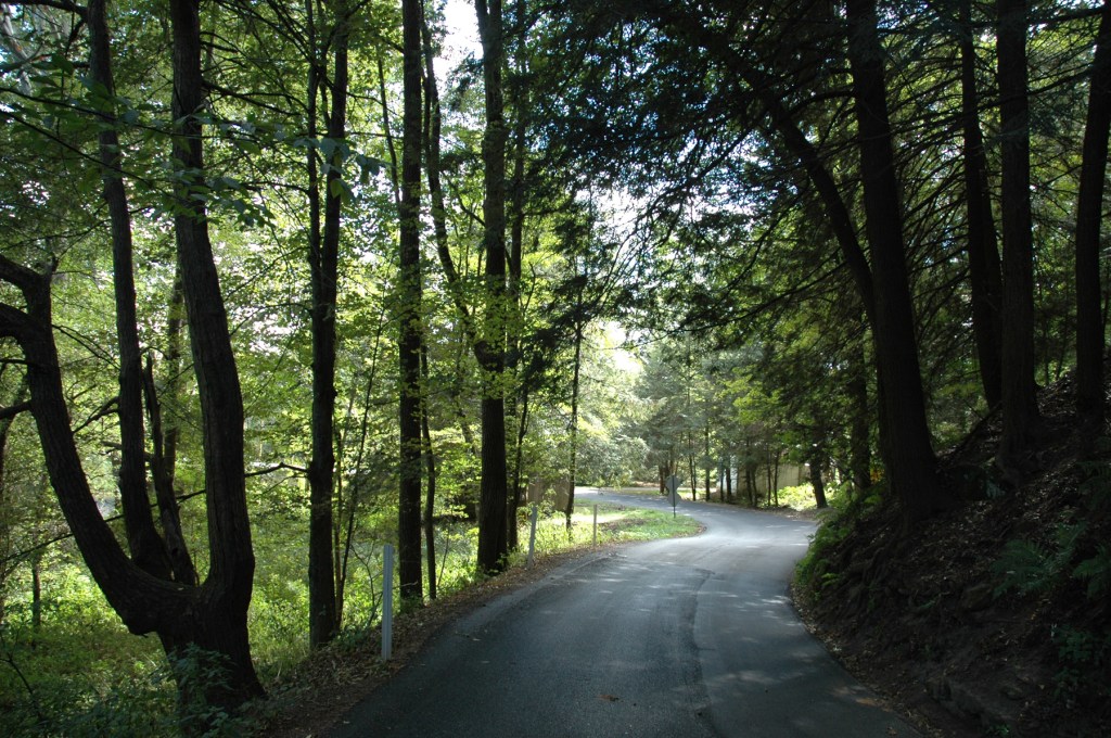
This series of photo essays takes a look at landmarks from the past that were once common and familiar components of the landscape to Richlanders long since passed on. A hundred and fifty years ago folks couldn’t really imagine a county without covered bridges, without hitching posts, without livery stables. Today the only way you have to picture these sights is with our virtual Richland Album.
This chapter from the virtual album features Mills of Richland County.

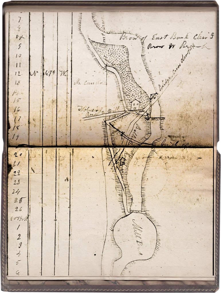
In early Richland County nearly every road led to a mill. The earliest log books of the County Commissioners are mostly details of laying out roads to connect farms to the mills that were so essential to farmers’ survival.
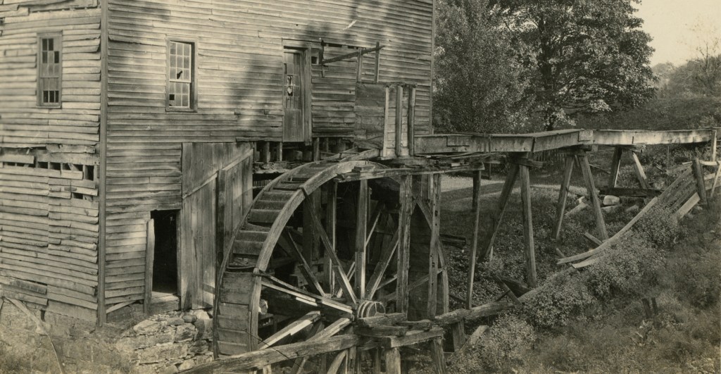
In the 1800s there were over 180 mills on Richland’s rivers and streams: sawmills, gristmills, mills for oil from flax or linseed, woolen mills. There was an abundance of river water running here—enough to power the wheels that turned agricultural produce into marketable commodities, and propel the wheels of commerce.
The mills were such a vital element of life back then, and drew so many people in like a hive of activity, that they attracted other businesses and services, and naturally coalesced into villages. Nearly every town in the county originated with a mill as the heart of its lifeblood.
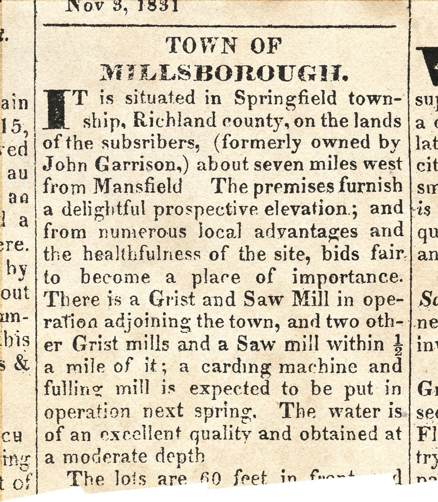
Nearly 200 years after the great age of waterwheels and millstones began here, there are very few traces left of those days: a few mill ponds, a few dry mill runs, a few gristmill-era names like Millsboro.
The world in which we find ourselves in the 21st century is rather severely divorced from the stern realities of our founding fathers’ time: today food comes from the grocery—not the barn; flour comes from Pillsbury—not the mill. Yet there still exists for us a small, humble reminder of our 19th century roots: at South Park on Brinkerhoff Avenue.
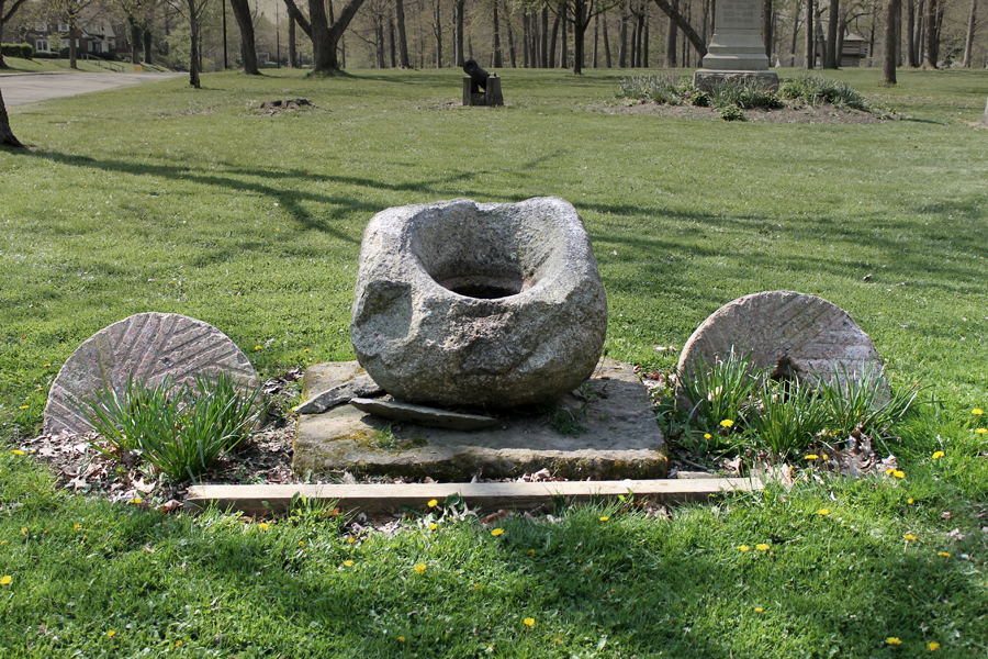
At the northern entrance is a simple garden that displays those essential tools without which our forebears could not have survived: two granite millstones, and a prehistoric grindstone used for the same purpose of processing grain 1000 years ago.
Today it is a barely noticed feature of the park lawn, but in the context of humanity’s need to eat in the wilderness, these stones constitute nothing less than a shrine to necessity, ingenuity, and hard work.
Several of the mills were diestroyed in various floods, and the last one was torn down in 1919.
BELLVILLE
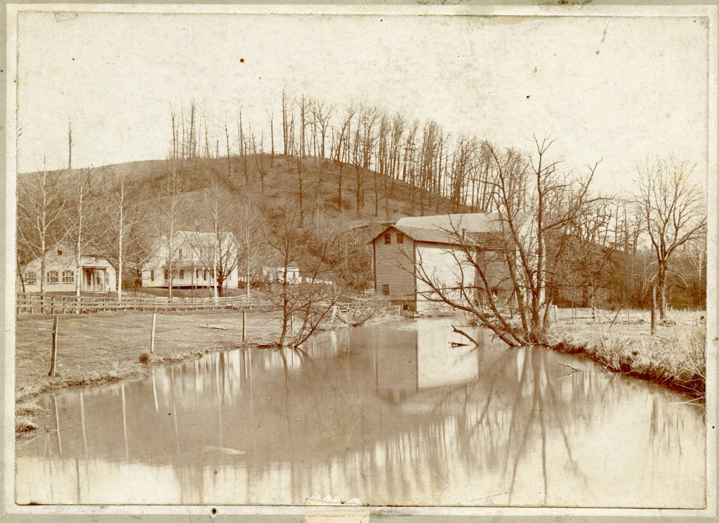
CLEAR FORK VALLEY
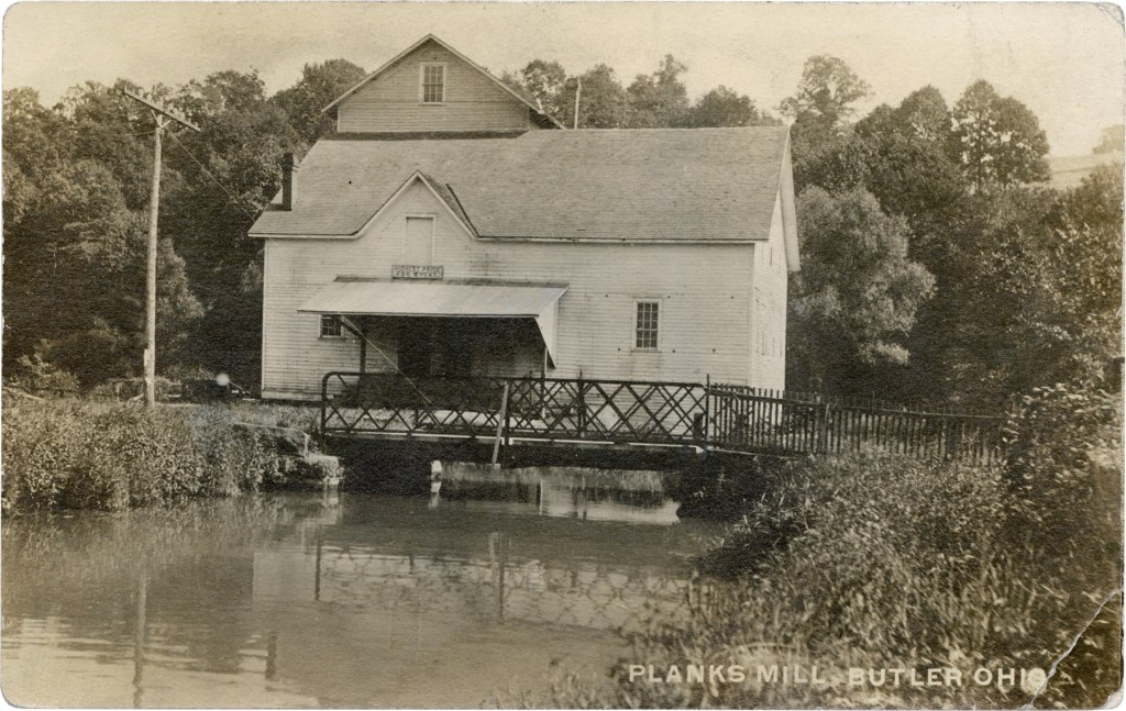
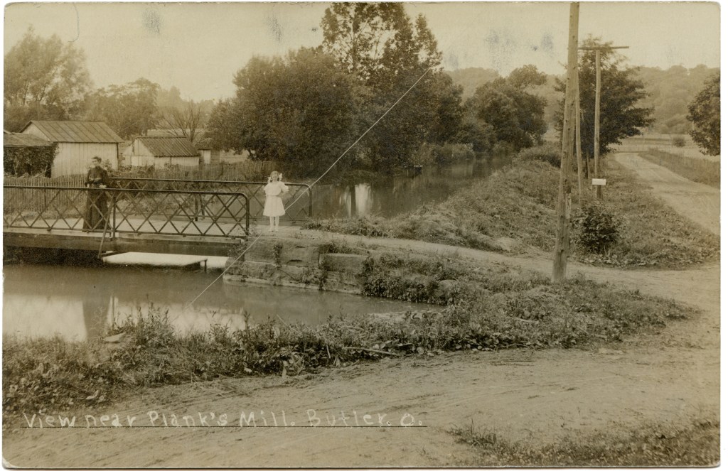
Shortly after the Civil War the miller recognized that the Clear Fork had enough power for more than one mill, so he cut the large building in half and moved part of it aross the river for a cider mill.
The half that stood on the north side of the river burned in 1885, and the other half was shattered by a falling tree in 1978.
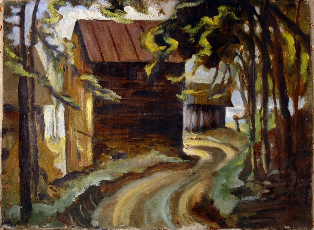
This oil painting of the mill was made by Margaret Twitchell Swank.
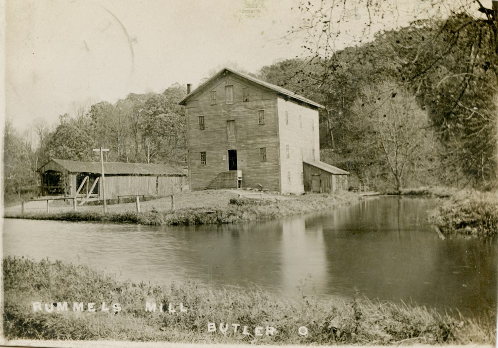
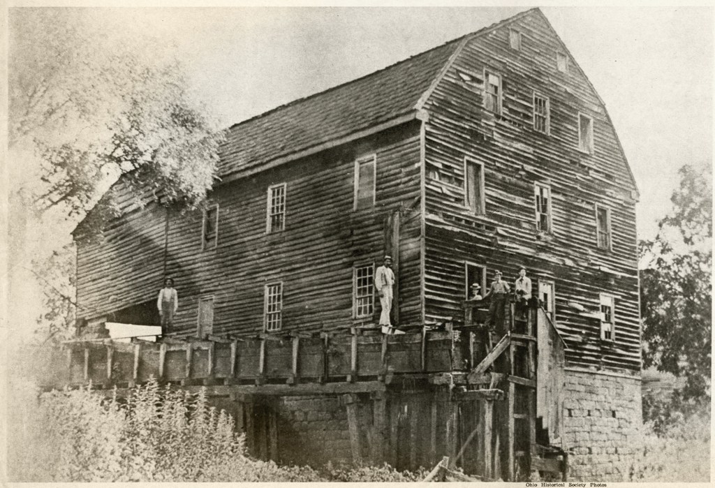
It was built in 1853 and, long after the old covered bridge beside it was replaced by a steel trestle bridge, the old mill stood through many floods. Certainly all the odds are against any wooden building that stands so close to variable waters.
With most of its works intact within the building an effort was made in the 1980s to preserve Rummel Mill but the elements eventually won and the building was lost.

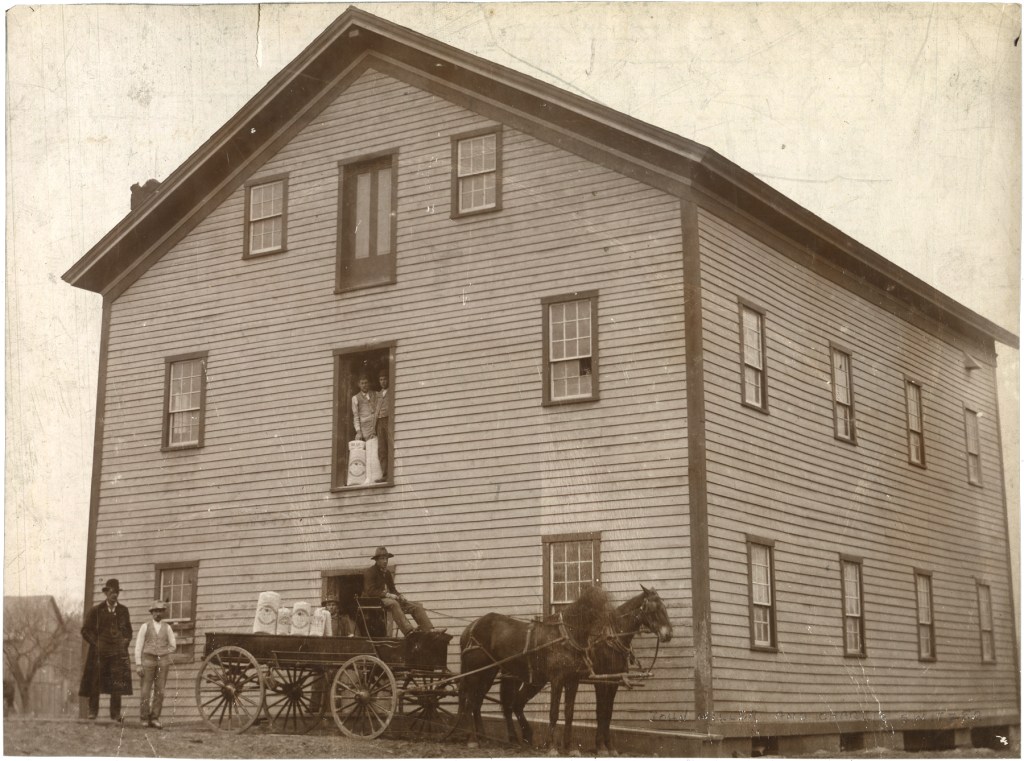
For many decades it operated as a woolen mill, and served as a community meeting hall, long outlasting Winchester itself. It was torn down in 1955.
MALABAR FARM
Built in 1841 to grind grain, the mill was already gone by 1939 when Louis Bromfield used its sandstone foundation to build the massive chimneys in his home across the valley.
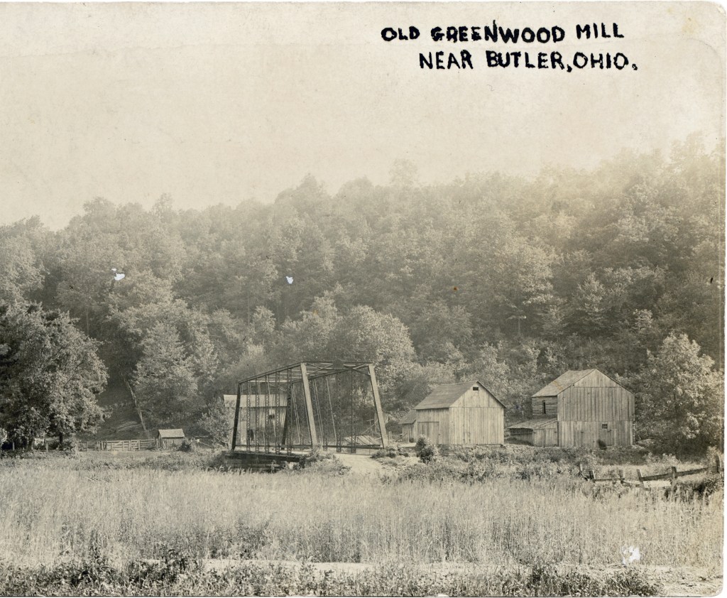
MIFFLIN & LUCAS
The mill was placed with good intention next to the Black Fork, but the river proved too variable, either too wet or too dry, for steady business. So in 1919 it was moved into Lucas because the village had electricity to power the mill.
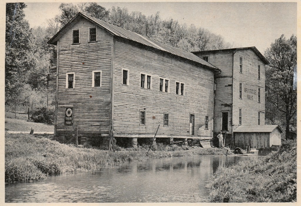
SHELBY
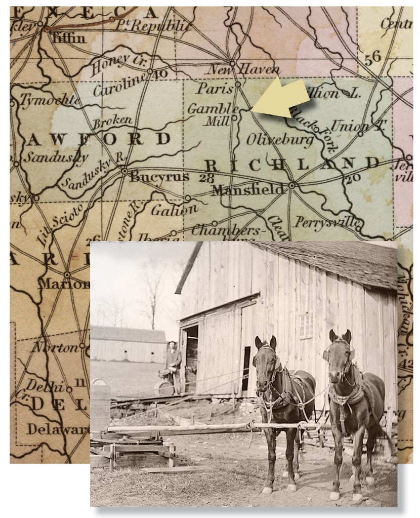
Unlike other mills on the Forks of the Mohican, the mill that Mr. Gamble operated did not run by water power, but by the steady slow plodding of horse power.
The mill for which Shelby owes its origin stood up the hill from the Black Fork River, on what is today the SE corner of Main & Gamble Streets.
The Gamble Mill was torn down in 1822. Shelby got its new name in 1834.
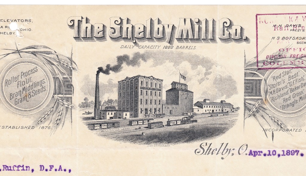
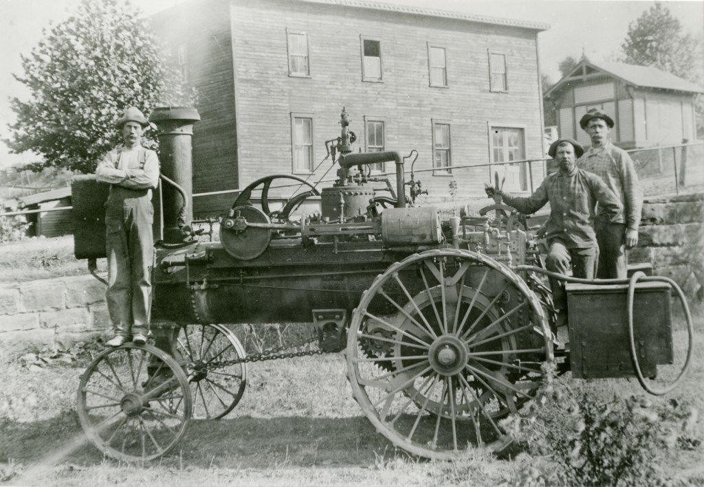
It was turning out up to 300 bushels of wheat a day when it was named Shelby City Mills in 1878. The mill lasted until 1920.
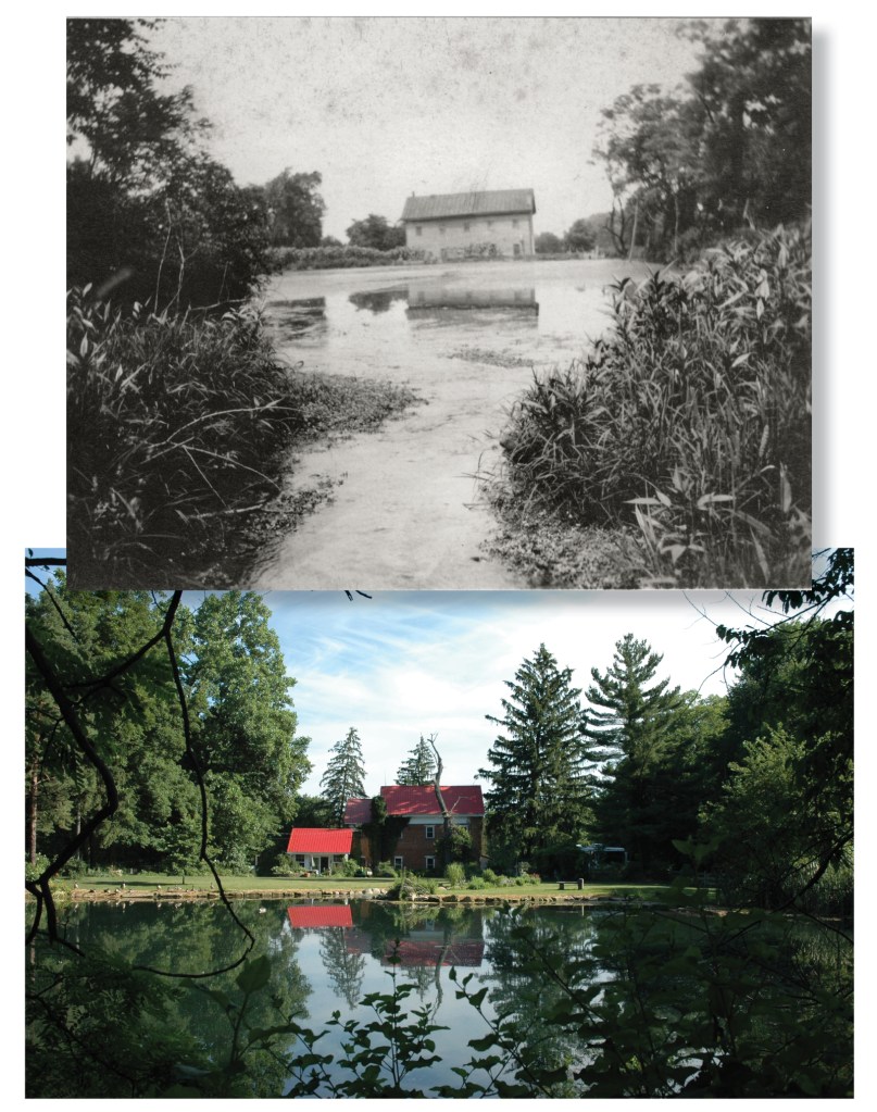
Built in 1817, then rebuilt in 1860, the last standing mill in Richland County survives as a residence, somewhat altered from its original configuration by fire and a brick facade.
