It is important to have the opportunity to be able to see your town all at once—to experience the wholeness of it. Our lives are spent on the ground, on a street, in a neighborhood; and the views we know are always, therefore, necessarily fragmentary, partial and only a piece of the whole.
But in order to understand and to feel the visceral sense of community, to appreciate the scope of the larger being we all individually help serve to embody; it is necessary to have a view of the bigger picture: all of it; all at once.
In Mansfield, photographers have been working on this for a long time.
The challenge has always been how to get up where the birds are with a camera.
The first attempt came in the 1860s when the art of photography was still fairly new science. Back then it was a wonder to watch balloonists ascend into the sky, and great crowds turned out on the Square for the events.
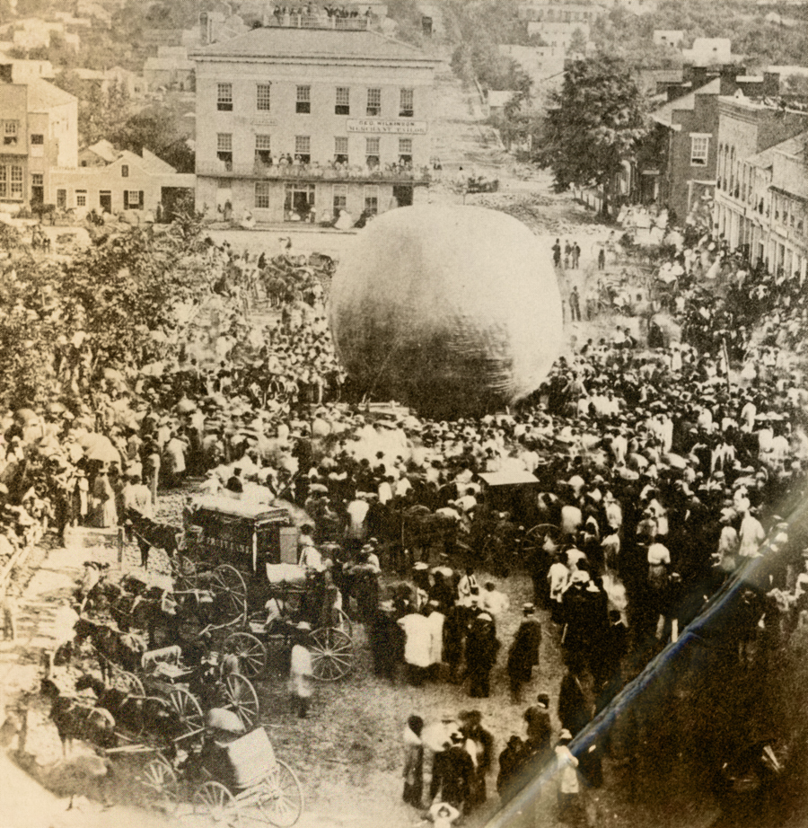
The photographic plates had to be exposed rather slowly at that time, so a camera man suspended underneath a balloon could capture a bird’s eye view of downtown only if the air was still.
Fortunately for us the crowd was able to hold its breath so the town could pose. This is the southwest corner of the Square around 1867: today it is the Mechanics Bank complex.
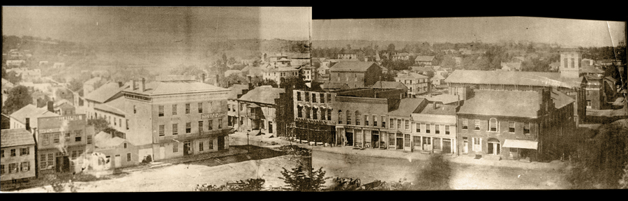
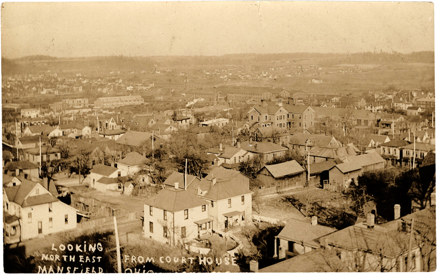
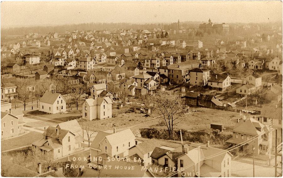
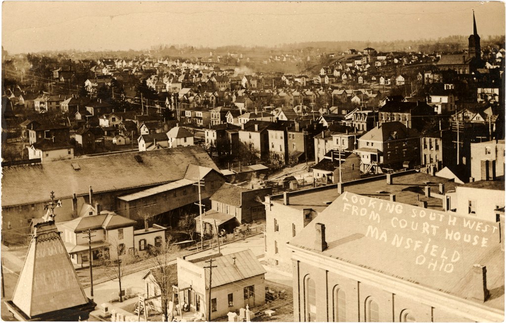
Within a few years there was a new vantage point in downtown Mansfield from which to photograph views overlooking town: it was the clock tower of the Richland County courthouse. Standing far above the treetops in the sky next to Lady Justice, a photographer was able to capture this series of images in 1909.
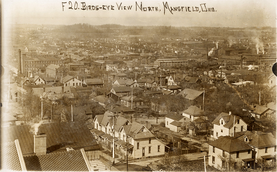

By the 1920s, it was not uncommon to see airplanes flying over town with the birds, so the art of aerial photography gave new perspective to our sense of downtown.

The 1920s brought a vastly expanded economy to Mansfield, and the city grew in all directions—not only outward but upward as well. The vertical skyline of downtown changed dramatically with the construction of our landmark skyscrapers, and photographers were quick to take advantage of the new view from on high.
In 1931, a photographer took his movie camera to the roof of the new Farmers Bank building at the corner of Park Avenue and Walnut to record the scenery from the top of the world.
Images include the industrial north end, the Richland County courthouse, residential areas out toward South Main Street, Saint Peter’s Catholic Church, the Square, Park Avenue West, Walnut and Third, three churches at Third and Mulberry.
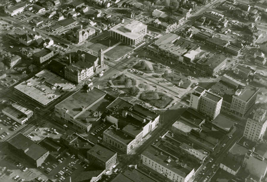
During the 20th century age of flight there was no shortage of aerial documentation focused on downtown. Photographer Tom Root of Plymouth made a life of capturing the view from high above. This image of the Square was taken around 1970.
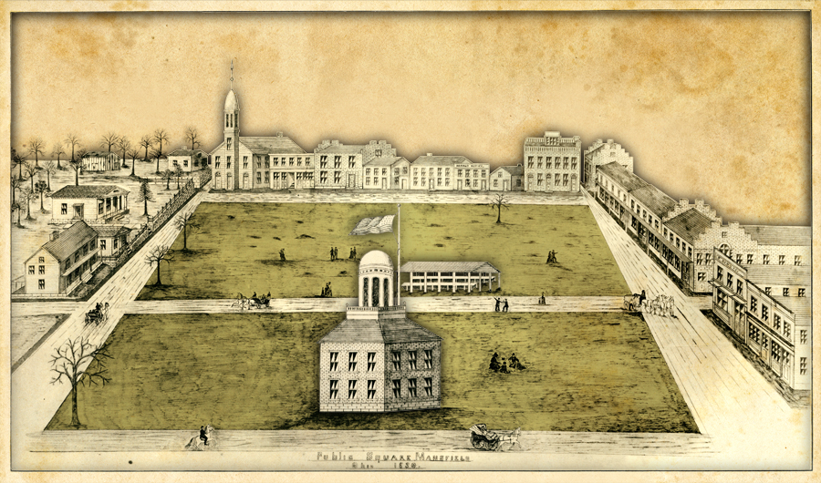
In 2010, photographer Jeff Sprang undertook to capture a skyborn image of downtown that could replicate the view produced by a 19th century artist who depicted the Square as it appeared in the1830s.
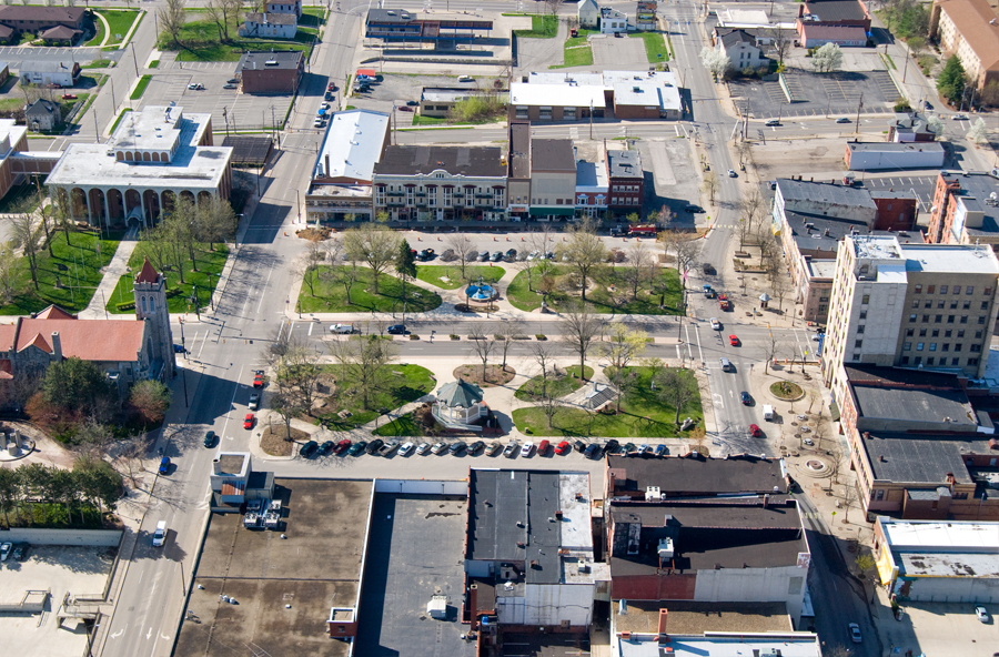
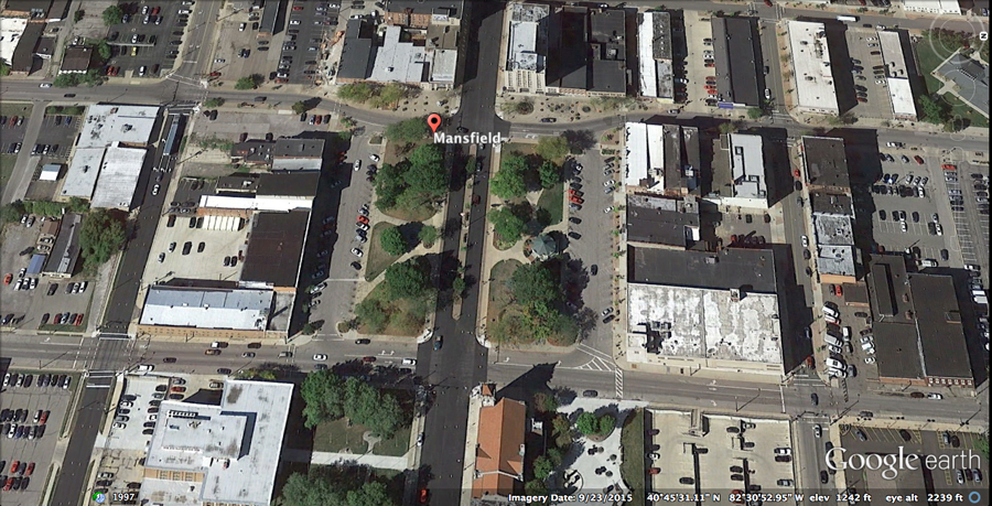
No doubt the next generation of aerial documentation of downtown Mansfield will be accomplished in high definition 3D imagery captured by drone technology. Until then we have access to the satellite perspective provided by Google science.