When is a square not a square? When it’s a diamond:

It all just depends on how you look at it. In America we have the traditional Town Square, but in Ireland, Scotland, England that same four-sided downtown gathering place would be called the Village Diamond.
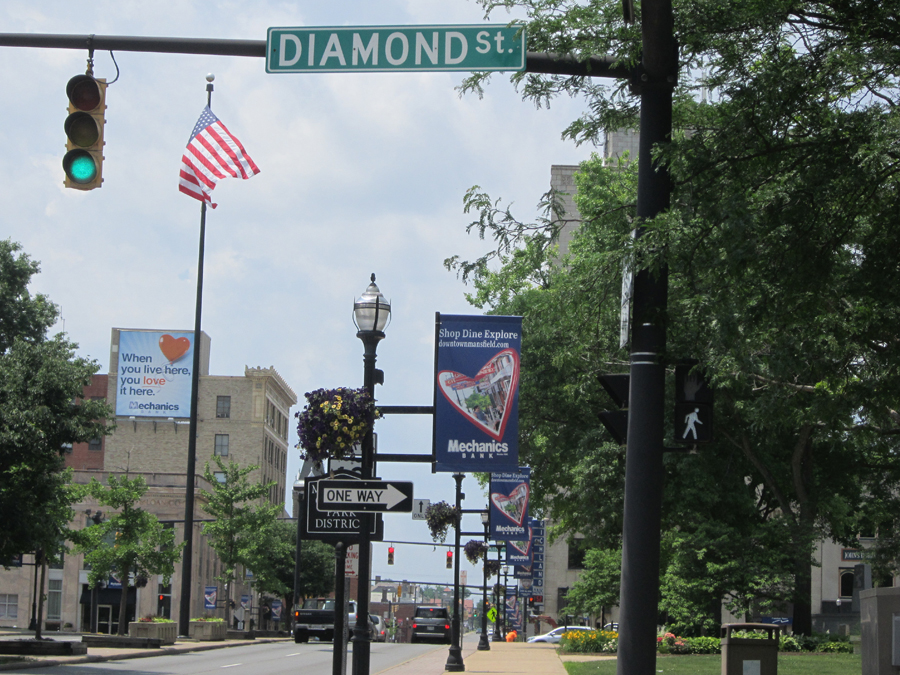
That’s why Mansfield has a Diamond Street. This is the story.
The Shape of Things
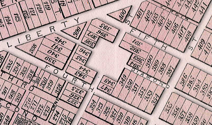
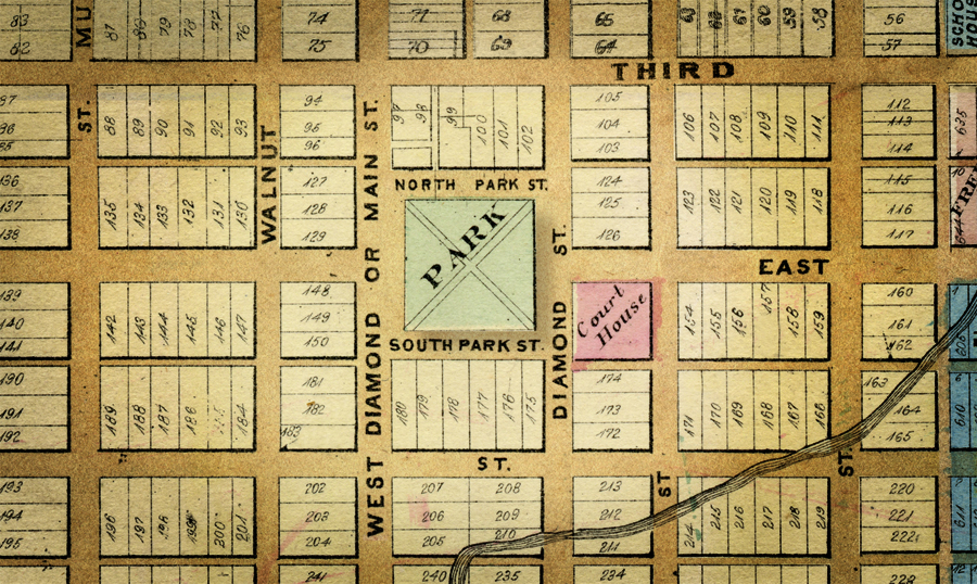
Interestingly enough, when Mansfield was born it actually had two Diamond Streets—East Diamond and West Diamond. They ran on either side of the square-sided market green in the center of the town’s plat, the two streets defining the public Diamond.
It sounds a little odd to someone from the American Midwest—to have a diamond at the center of town as opposed to a square—but it wouldn’t seem the least unusual to somebody from Ireland, Scotland or England.
That somebody would be Joseph Larwill, one of the three men who founded Mansfield in 1808. He helped lay out the town grid and he was born in England. He also learned his surveying skills from the college at Pittsburgh: another city in frontier America that had a Public Diamond at the center of its downtown instead of a Square.
Pittsburg also had a Diamond Street adjoining its square.
A Nation of Immigrants
When you’re in Ireland, you’ll find lots of towns that have a conspicuous village diamond—including a very famous one in Monaghan where a statue commemorates a famous 1795 historic event known as the Battle of the Diamond. Joseph Larwill grew up in Chesterton, England, which did not have a diamond, but several of the towns close by did—including the university town of Oxford only 10 miles away.
Larwill was nine years old when his family moved to America, and they first settled in Philadelphia—which today has a Diamond Street Historic District. When he attended the Academy that is today U Pitt, the school was situated downtown only 5 blocks from the Pittsburgh diamond.
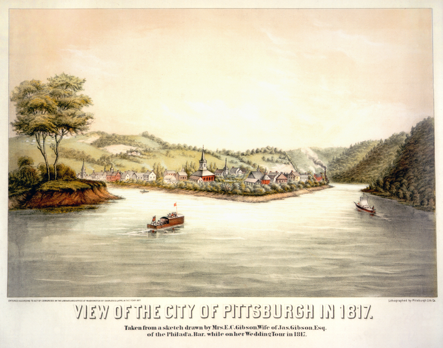
This portrait of Pittsburgh was painted at the very time when he was in school there.
Larwill’s Notebook
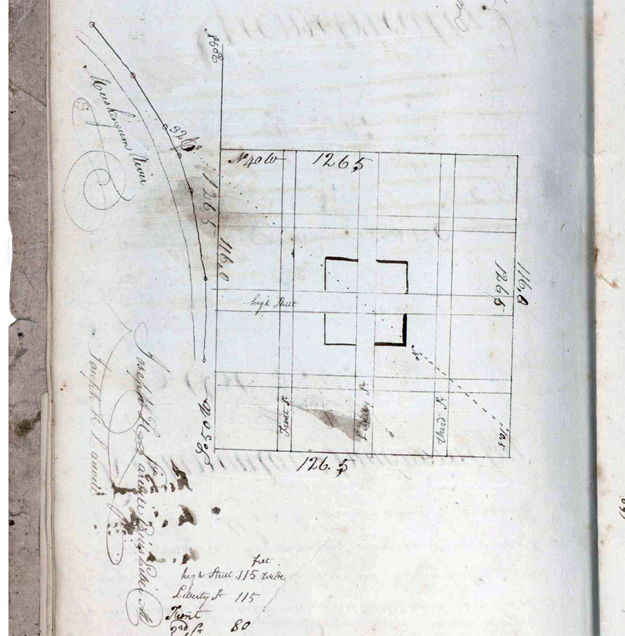
One of the prized holdings in the University of Pittsburgh Library System is a rare manuscript student notebook that survives from 1800 when the Academy was new—the math lessons of our own Joseph Larwill. His notes are scrawled in that distinctive walnut-colored early American penmanship that comes from writing with a quill pen, and include pages of equations, theorems, and long numbers.

There are also more than a dozen pages where he signed his name: sometimes as if practicing various possibilities of fancy ornamentation, and sometime—more obviously—simply bored out of his mind.
After pages and pages of Square Roots, Cube Roots and Plane Geometry, the notebook has a couple pages with very intriguing sketches that were clearly daydreams of the young student surveyor: grid designs laying out the plat of an imaginary town. The drawings are labeled with street names, and one of them has what is clearly intended to be the layout of a town square.
Larwill’s square in the center of his hypothetical map is drawn with a dotted line running diagonally through it: making it appear perhaps as less of a square and more of a diamond.
Theory and Practice
In 1804, when Larwill was 20 years old, he was appointed by the U.S. Land Office to survey the wilderness in Ohio. By 1808, his imaginary town grid was no longer theoretical—it was staked out on a hilltop clearing in Richland County as the foundation of his first actual town: Mansfield.
On the east and west sides of his central public green he designated the streets East Diamond and West Diamond.
Later, of course, West Diamond Street became identified as Main Street—but it wasn’t right away. As late as the 1873 atlas it was still labeled as a Diamond.
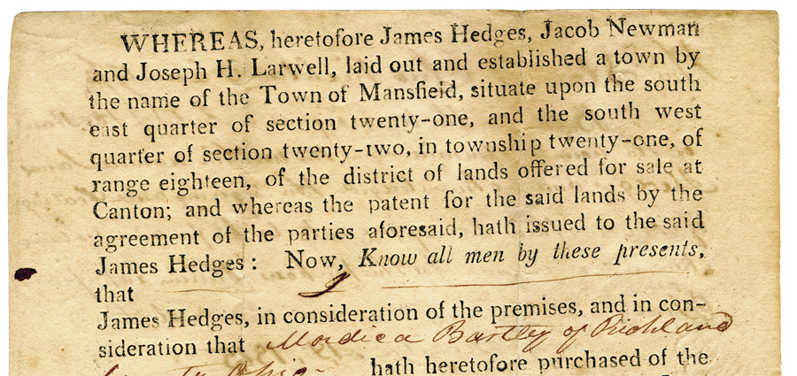
Larwill, as a surveyor for the government land office, was a friend of Hedges, and he took upon himself the task of laying out the shape of Mansfield. Later that same year he platted another town east of here, Wooster, where he subsequently spent his lifetime.