The Intersection of Main & Park with Time & History
There is a Main Street in nearly every town of the Midwest. That, in itself, establishes a depth of mythos as an archetype of American identity opening a profound reservoir of meaning.
In Mansfield we also have a Public Square—which is a concept of civic trust that long predates America itself—encoding into the center of town a psychic energy far deeper than the realms of history, and tapping the ancient tribal power of pure anthropology.
So, when we go to the place in our town where Main Street and the Square overlay one another we stand on a truly consequential site in our community where the transcendent importance of humanity intersects with the temporal fabric of today.
It’s the intersection of space and time: of place with story.
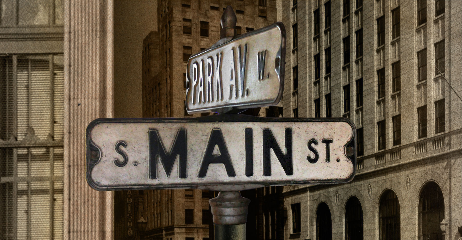
It is the crossroads of Main Street and Park Avenue West.
Placing & Shaping the Space
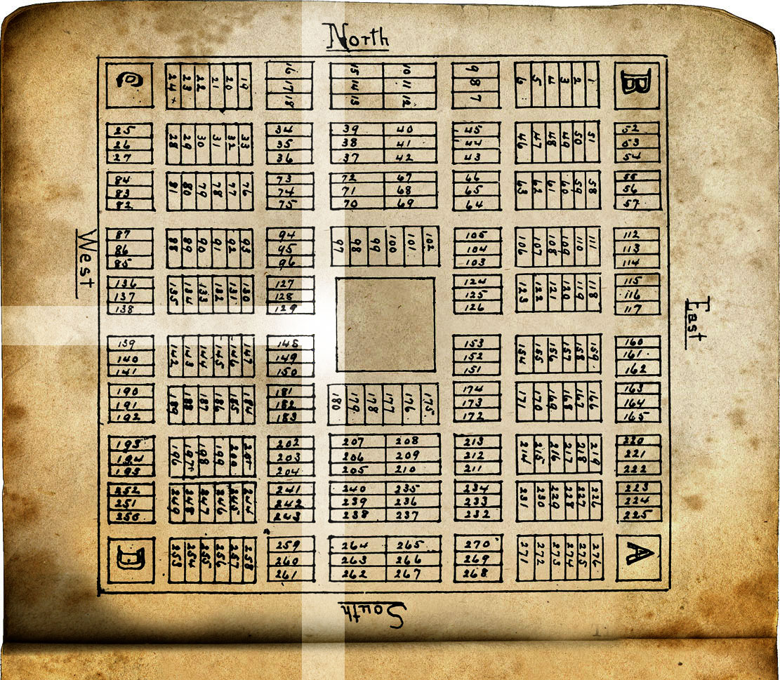
When the whole idea of Mansfield was first imagined by a few surveyors standing in the forest, it was given its form as lines on a paper where four imaginary streets outlined the parameters of a publicly-owned heart of the town.
Two of these opposing lines pointed North and South in a presumed alignment with the poles of the Earth, theoretically leading to Lake Erie and the Ohio River.
The other sides of the Square—pointing East and West—were considerably shorter, serving only to contain and define the Square by connecting the two principal thoroughfares.
In order to connect the Square to the Western migration of the young United States by providing a route proceeding East and West, the planners drew a road from the middle of the Square that traced the path of the American sun westering across the land.
Of the twin North & South tangents, one was always the main road because it connected Mansfield with its nearest neighboring lifeline on the Ohio frontier: Mount Vernon. As soon as the State of Ohio sponsored public highways, it was designated Route 13.
The crossroad proceeding westward from the Square to San Francisco was called Market Street for several generations of Mansfield’s life, until the city parks were located out that road, at which time it was changed to Park Avenue.
Main & Park
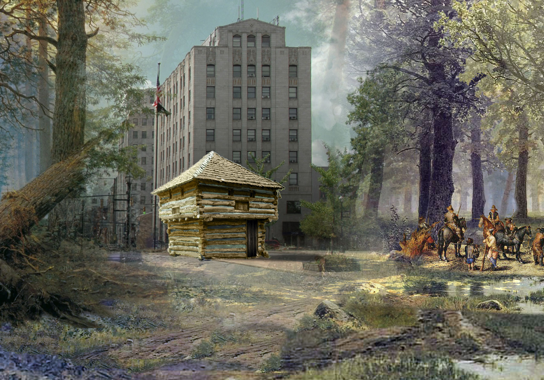
The intersection of Main & Park is fundamental to the basic essence of Mansfield. It is the first pin in the map. It’s where the soldiers put up the first blockhouse in the War of 1812: the first public building that claimed this patch of wilderness as a safe place to call home.
Every stage coach to Mansfield passed through this intersection, and decades later there were streetcars through it every few minutes.
Every sort of person the town ever harbored passed through there at one time or another.
It served as a stage for the epic parade of humanity, and also, literally, holiday parades of every dimension of fanfare. The place has seen so much celebration it is saturated through the ethers suspended between epochs of generations.
The meeting of Main & Park is a convergence of Mansfield with America.
All we have to remember those bygone scenes we never witnessed are the digital semblances collected here. Somehow these visible echoes must suffice to give form to the lives long passed away, and suggest the spirit of the place that will animate the future of our town.
An Album of Our Shared Common Background
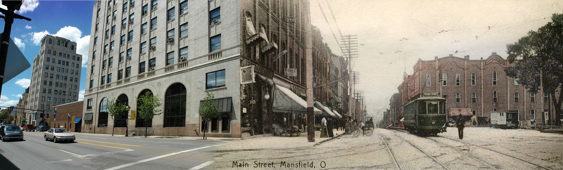
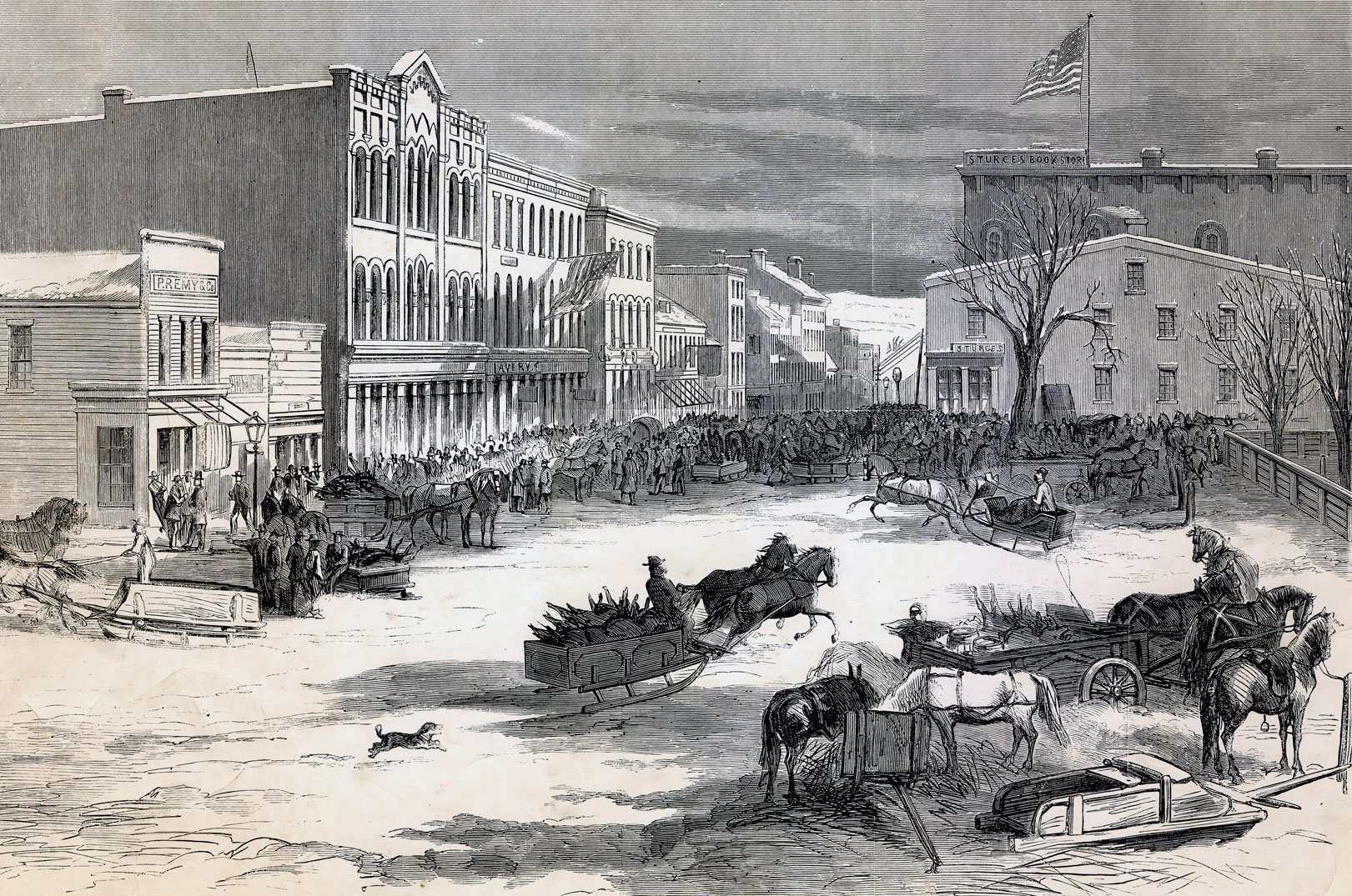
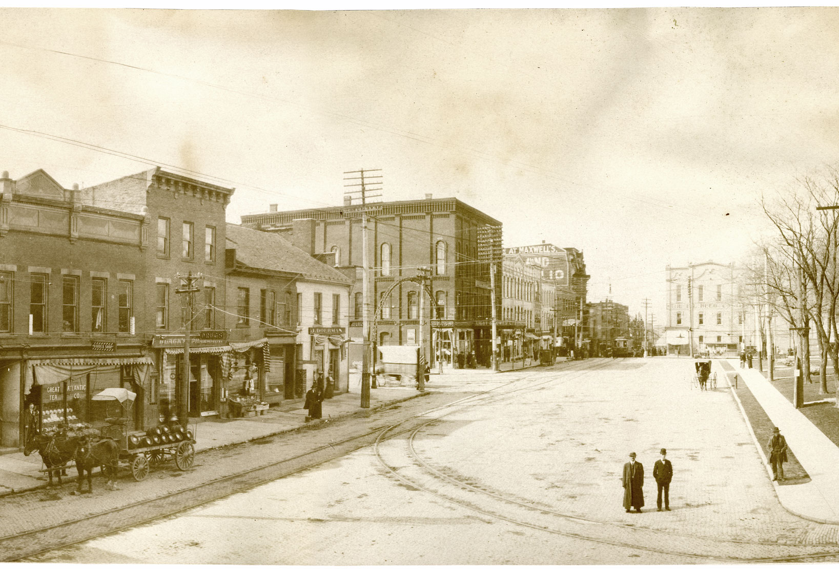
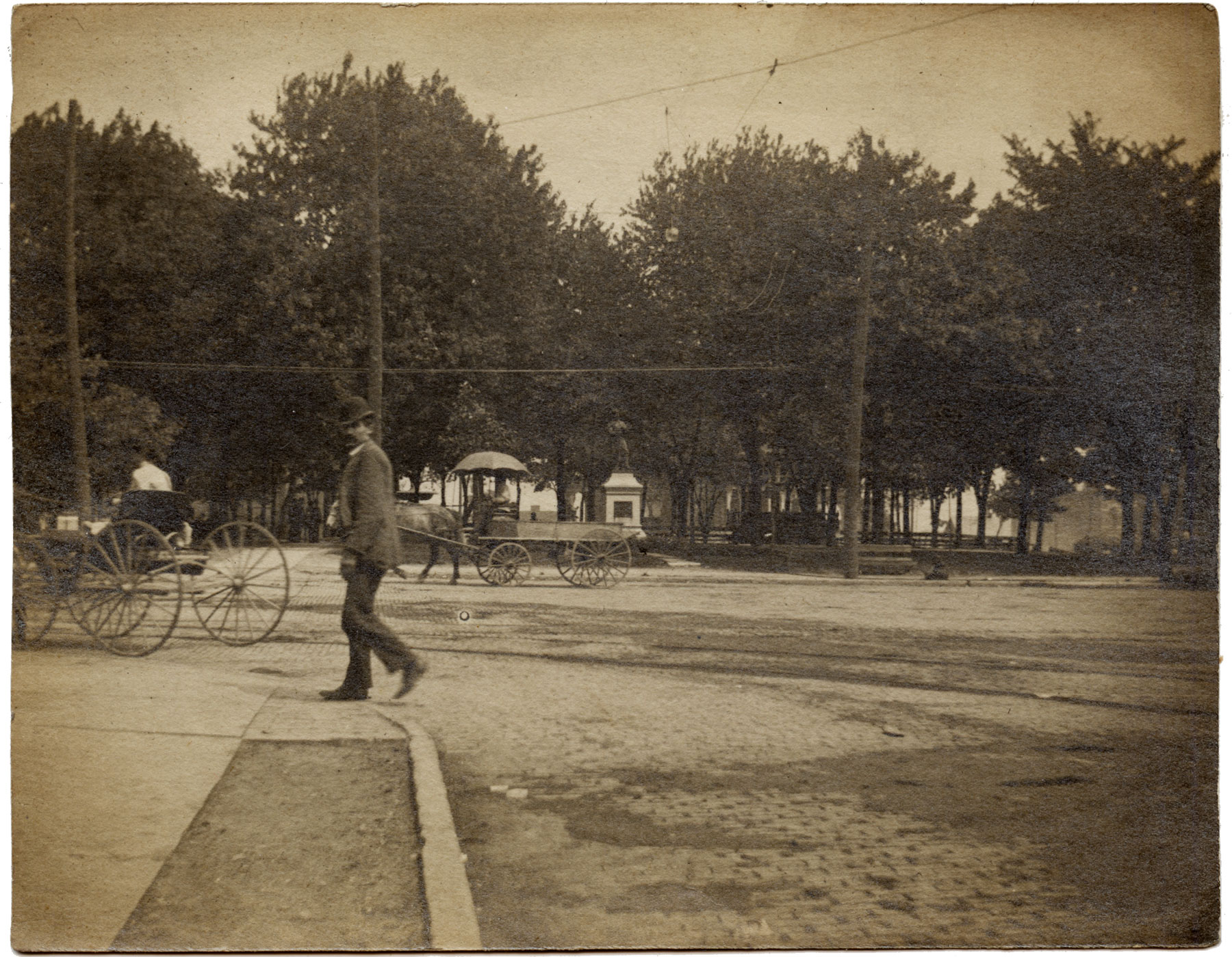
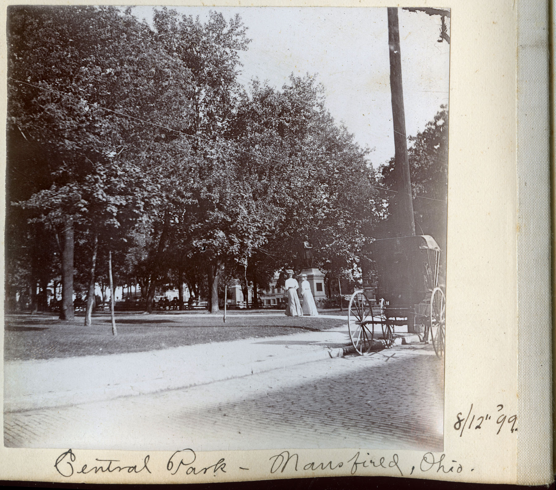
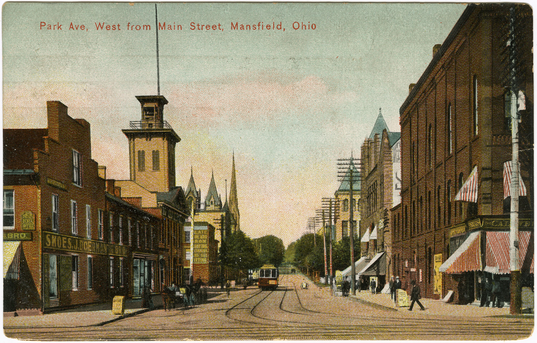
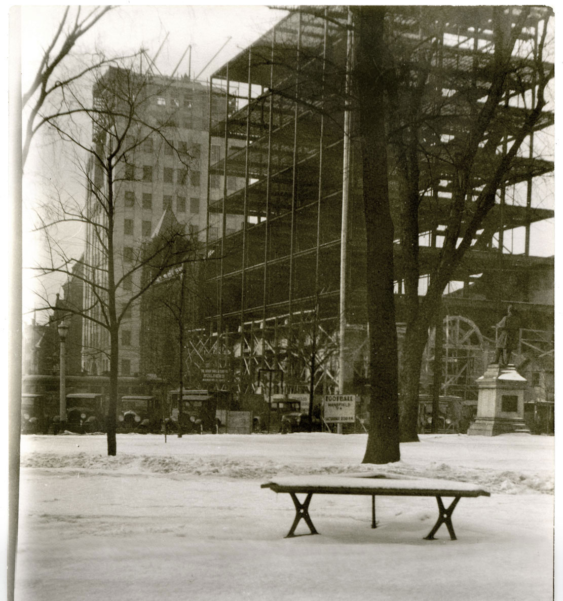
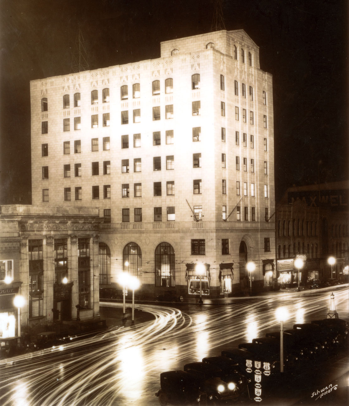
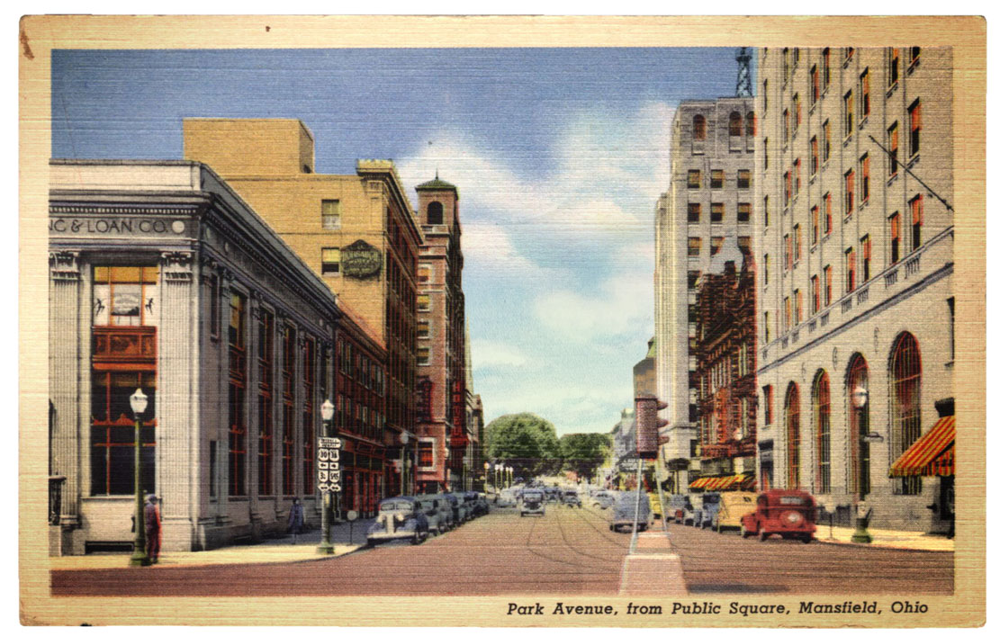
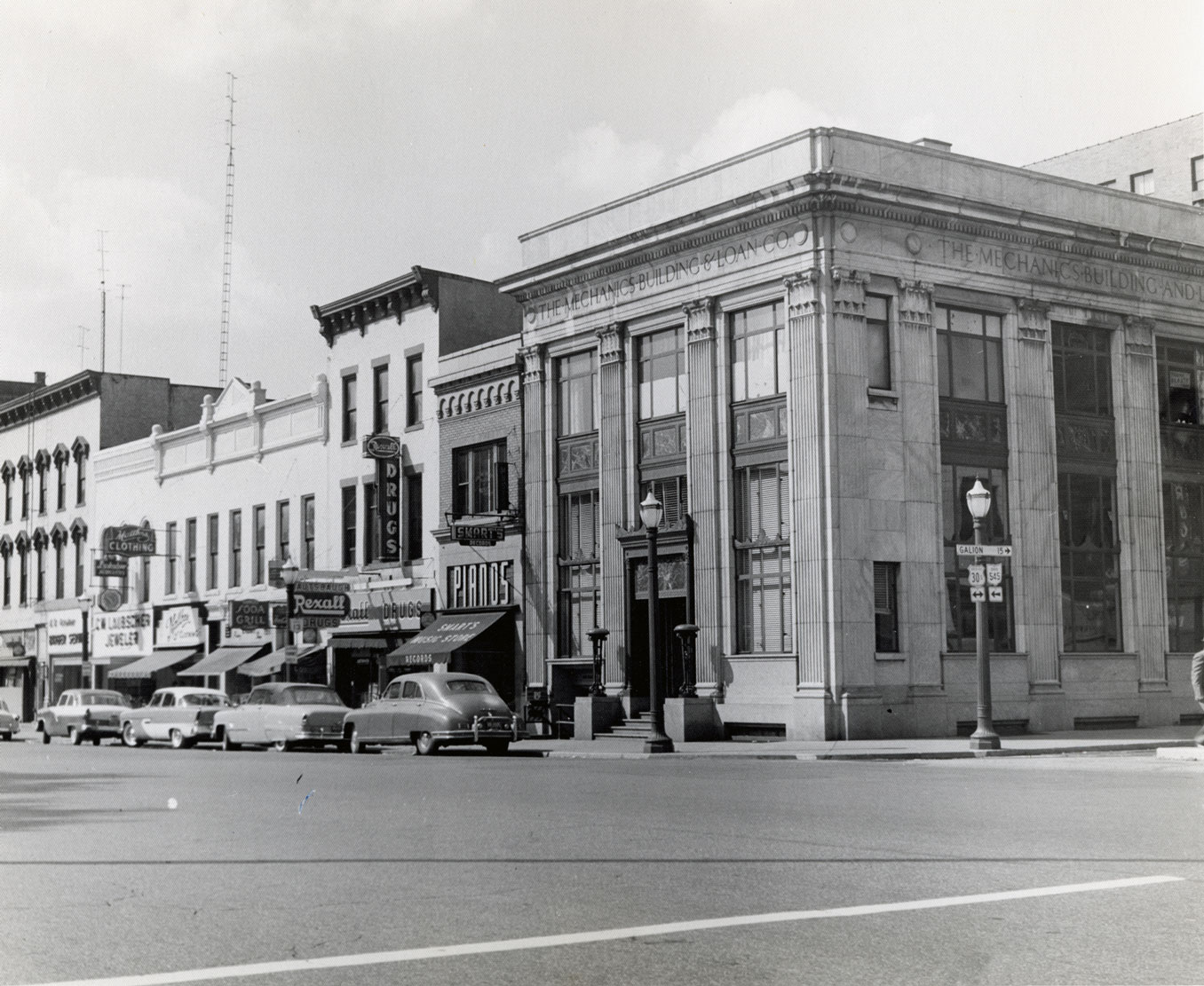
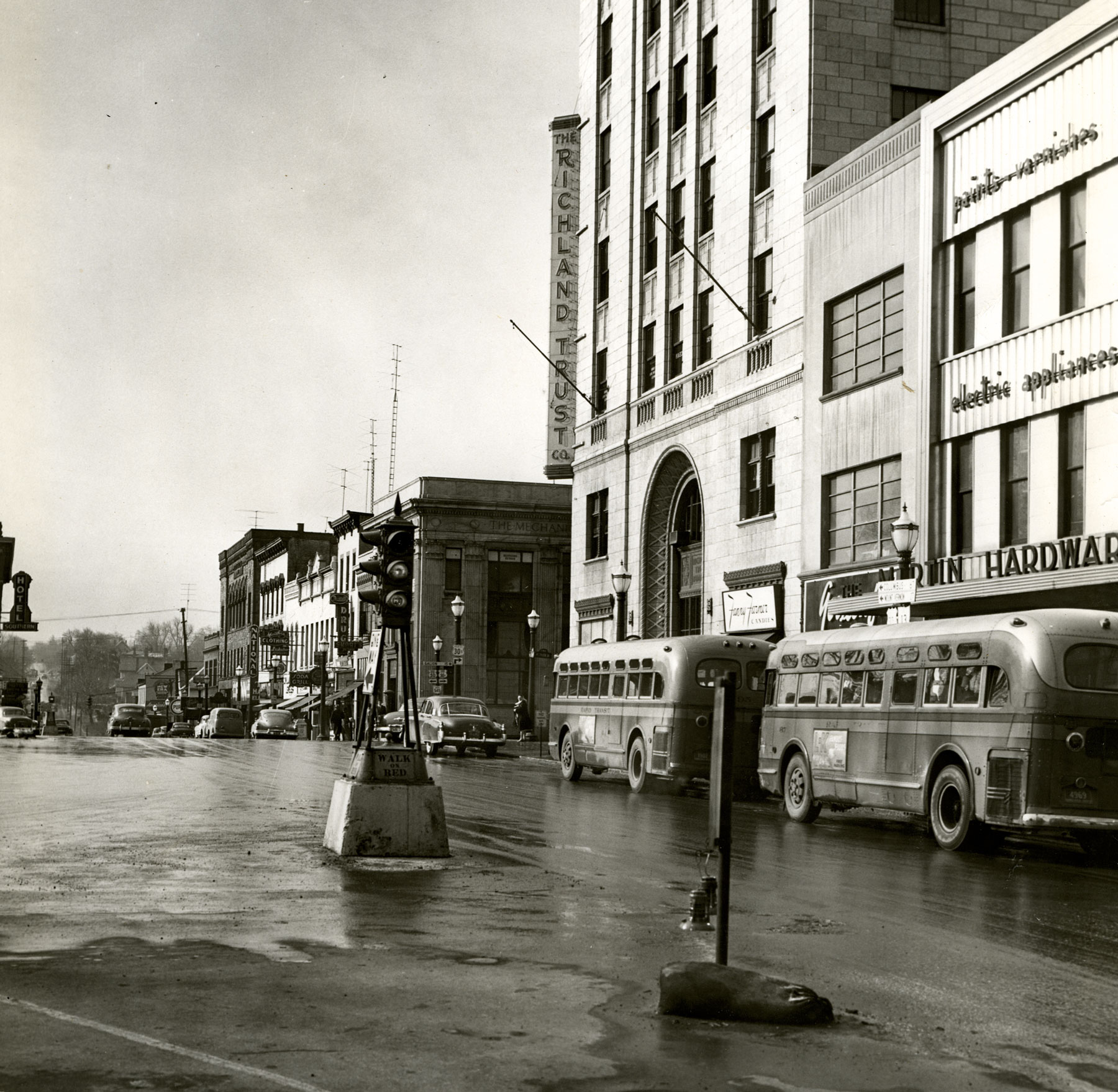
Overlaying two scenes of the same place two hundred years apart gives a sense of exactly where the first rough-hewn blockhouse was placed in the Square in 1812.This professional woodcut print published in the New York Illustrated News in 1862, depicts the oldest and most established block of Main Street at the Square during the Civil War years. The NW corner of Main & Park, seen in the left foreground, had a little frame General Store that was picked up and moved in 1864 to make way for the brick building seen below.The northwest corner of Main & Park got this landmark to anchor the Square from 1864 to 1926. The principal sidewalk storefront was the Caldwell & Bloor drug store, and it shared Main Street with a nickelodeon called the Arris. The second floor was a maze of lawyers’ offices, and the third floor was Mansfield’s armory.Streetcar tracks show this stretch of Main Street a modern urban center of 1911. Notice the portal of lights set in a wrought iron archway where Park Avenue meets Main, placed in 1908 to illuminate Mansfield’s centennial year.Mansfield was called the Mecca of Democrats in September of 1908 when a huge convocation of the species from all over the state convened for a day of political speeches and parades. The event was covered in detail by the city’s Republican newspaper, who focused particularly on how candidates “carefully dodged the issues,” and most particularly about the quality of cigars being distributed by various politicians. They didn’t mention what the umbrellas signified, as it did not rain that day.Looking east from Park Avenue West in 1899 shows what a park-like shady grove Central Park had grown into.Photo albums of the era frequently show friends and family against the background of the city’s scenic urban forest.This postcard gives an excellent idea of what the Main & Park area looked like before the whole skyline vigorously evolved in the 1920s. It was a wholly 19th century town well into the 20th century, with many church steeples and architecture evoking early American commerce.The first radical modifications of Mansfield’s downtown skyline took place on the south side of Park Avenue, spreading westward from Main with the Mechanics Bank building in 1926, the Walpark Building in 1926, and the Leland Hotel in 1927.The Farmer’s Bank tower, seen in the background, and the Richland Trust Bank rising in the foreground, completely recast the sense of downtown from modest urbanity to urban vitality in 1929.
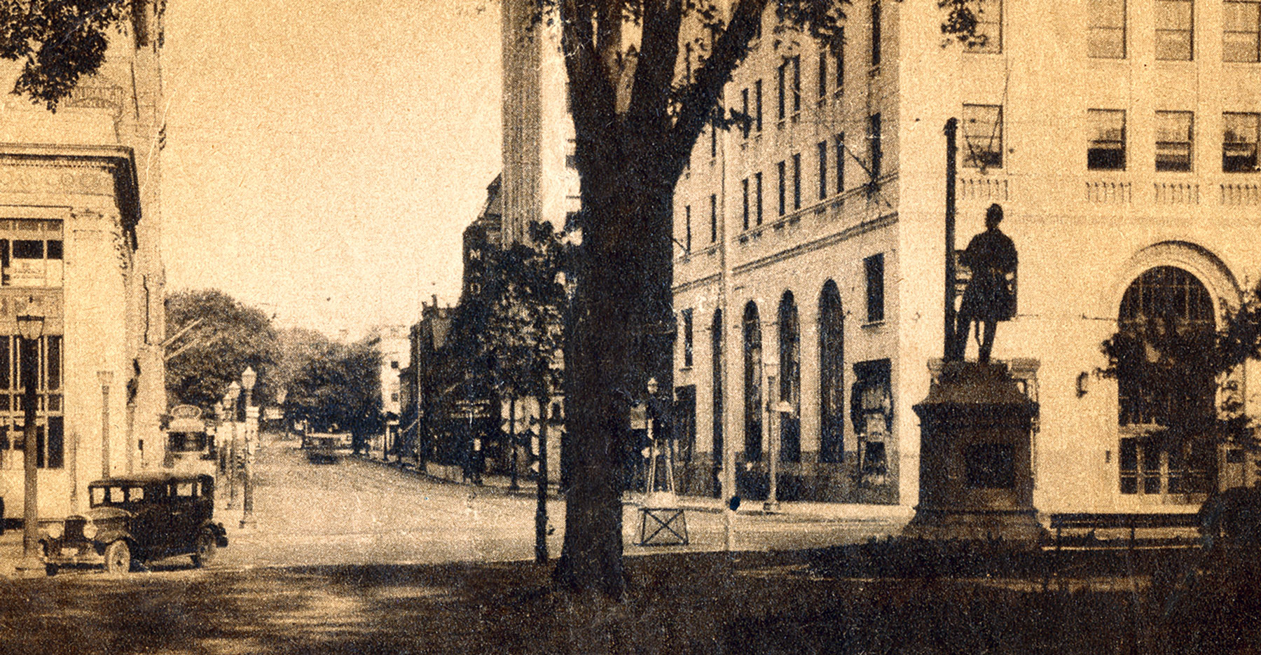
Main & Park in the 1930s captured in its full exuberance of night life.Keeping his eye on the western expanse of Park Avenue and guarding Central Park was Mansfield’s Civil War memorial placed in 1881. Most Civil War monuments of that era had their soldiers facing South to remember the sacrifice made by its community, but Mansfield’s was purposefully directed to the west in order to recognize “the great lands that were saved for the Union.”This portrait is among the all-time favorite pieces of Mansfield Memorial Day Americana: it has wisdom and naivety in the old man and his grandchild; sun and shadow; stars and stripes; orators of the Republic in the distant background, and ice cream socialists. Pathos and ethos of some long ago age that still informs our national soul. All on the Square in Mansfield in the 1890s.As the original clearing in the wilderness that gave rise to the community, the public Square has always been the heart of Mansfield, and throughout the two centuries of the town’s growth, that is where matters of the heart and head have been voiced as a community.
What began in 1920 as the town’s community chest, providing sustaining funds for humanitarian organizations—ranging from the Salvation Army to the Playground Association—later became United Appeal, known today as United Way.
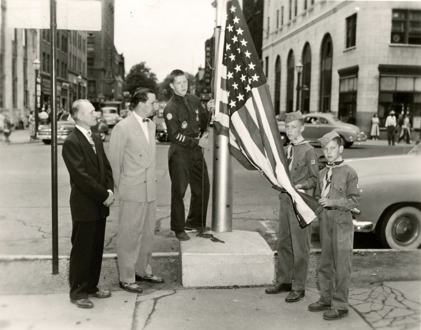
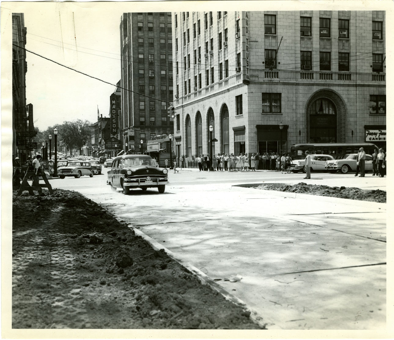
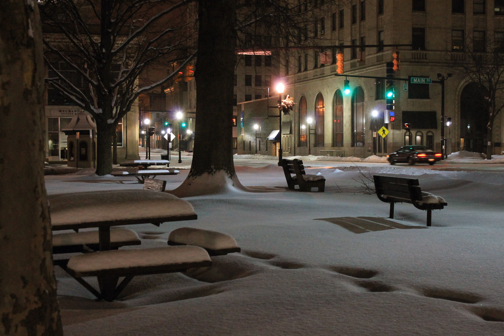
This campaign sign at Main & Park is from 1931.Just beyond the commercial blocks of downtown it is plain to see that Park Avenue was still a tree-lined residential street in this 1930s postcard.The southwest corner of Main & Park in 1957: the city hired Meter Maids for the first time because apparently they could afford them. There were more than 400 parking meters downtown raking in over $60,000 a year, and since the meters had been installed in 1940 the city had made $281,000 off them.In the early 1950s the Square was still operating as a traffic roundabout with traffic lights at car level on concrete islands.The Scouts of Troop 16 raise the 48-star U.S. flag for the last time before that flagpole is to be uprooted from the western side of the Square. In 1958 cars will soon be able to drive right through this hallowed ground.The Public Square became a public thoroughfare in 1958 when city officials directed the ceremonial first driver over the new pavement, following years of bitter conflict to preserve the sanctity of the Square.This news photo from 1977 shows the Main & Park block before the streetscaping was redesigned with wider sidewalks, fountains and planters.The easiest way to image Main & Park throughout the ages—both past and future—is with a soft layer of snow to erase the hard lines of now, and lay out a fresh white canvas on which to project new designs of the world to come.
U.S. History @ Main & Park
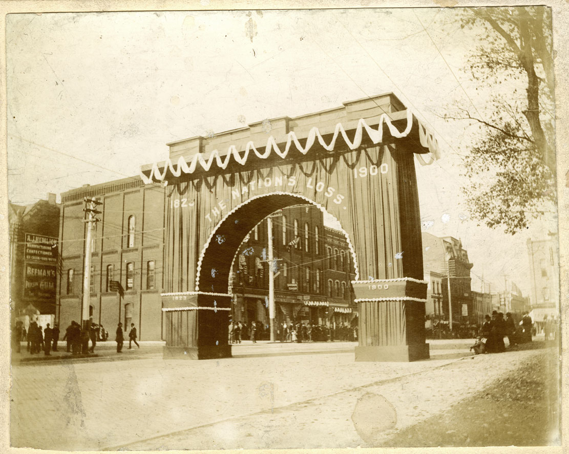
In December of 1900, the historic block was crammed full of mourners, politicians, Senators, Congressmen, Cabinet members, and the President of the United States in procession to lay Mansfield’s elder statesman John Sherman to rest.
The great Sherman Arch was built on the Main Street & Park Avenue site as a portal from which the old gentleman could leave his hometown. Quite a few of Washington’s most historically notable celebrities of the era left their footprints on this spot next to Central Park.
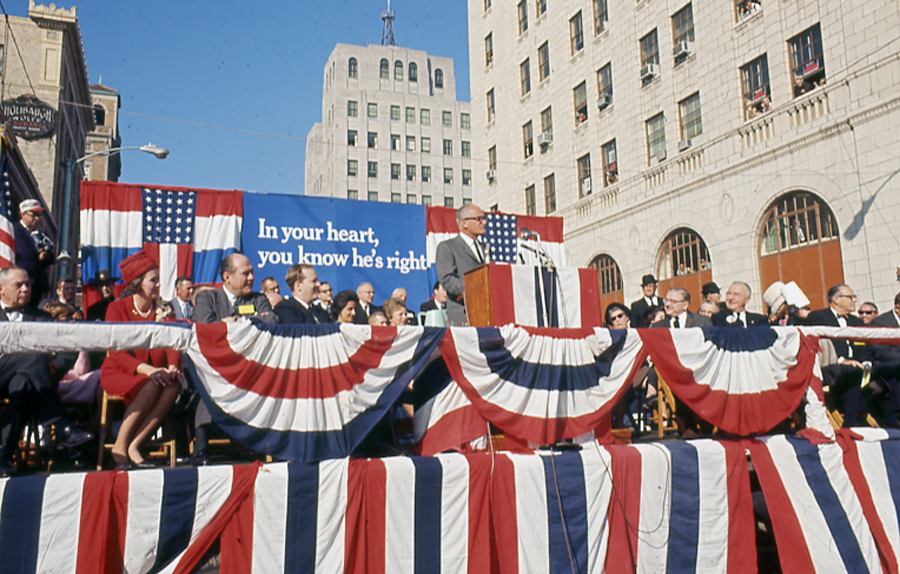
Presidential candidate Barry Goldwater campaigning in Mansfield October 17, 1964. Accounts said 15,000 folks gathered, more kids than adults, in a sea of Johnson/Humphrey signs, but even the hecklers were polite.
On September 15, 1942, thousands of Mansfielders jammed into the west end of the Square at Main & Park to raise money for WWII by buying War Bonds:
Thank You!
Images in this photo essay come from Brett Dunbar, Marge Graham, Ohio Genealogical Society: Richland County Chapter, Sherman Room of the Mansfield/Richland County Public Library, the Mark Hertzler Collection, Phil Stoodt, Charles Weaver, Betty Angle Fox, Virgil Hess, and Will Harmon. Film footage by Harry DeLaney.
Post Script:
So what really happened to the Leland Hotel? This view captured from Central Park at Main & Park makes clear what the downtown planners mean when they talk about the footprint of parking lots.