If you look at the shape of Richland County on a map and pay close attention to detail, you will notice a small angular discrepancy in the line of its lower edge: like someone dropped it and dinged up the corner.

That odd little chip off the corner represents an interesting principle in the study of history that goes like this: something which doesn’t seem to make sense in one era can make perfect sense when seen through the lens of a previous era of the past.
Some history bleeds through many lifetimes with inscrutable mementos.
Richland County’s missing corner is like a fossilized memory—perhaps a scar—left behind from an age when things were vastly different from our own.
That distant age was more than 200 years ago; that scar was called the Greenville Treaty Line.
1795
The United States was only 19 years old when these events took place. To the young nation at that time Ohio was regarded as an uncharted wilderness. To the tribal folk who lived in Ohio, it was simply home.
The decades of struggle whereby the Ohio country went from being the wilderness home of Native Americans to becoming a charted possession of the United States, are told in a sequence of violent challenges back and forth: attacks and reprisals, wars and treaties.
The specific battle that is regarded as the culmination of Ohio’s hostilities and the end to local dispute took place in 1794 at a site near where Toledo is today. It was known as the Battle of Fallen Timbers, and is commemorated in U.S. history books as the event on the timeline of western expansion that signaled when Ohio became safe for settlers.

A year after the battle there was a great conference convened so representatives of the United States and Chiefs of the loosely confederated tribes of Ohio could come to agreement about how Ohio was to be divided between the Indians and the settlers.
They took a map and they drew a line.
The negotiations were held at Greenville, and the document they all signed was called the Treaty of Greenville.
The line was called the Greenville Treaty Line.
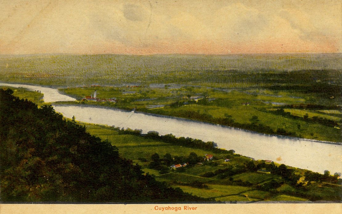
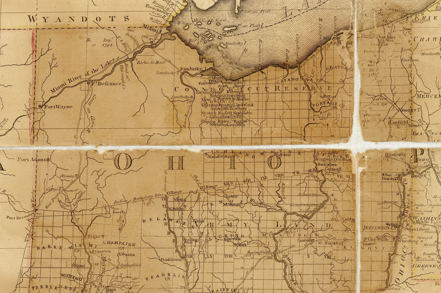
It was inked on the map in a straight stroke between two U.S. military forts—one in the east and one in the west—with an extension down to the Ohio River on the west end and an eastern boundary northward to Lake Erie by way of the Cuyahoga River.
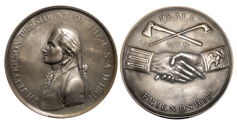
The Greenville Treaty, executed by General Anthony Wayne and eventually signed by President George Washington, specified that as of August 3, 1795 everything north and west of the Treaty Line was, and would forever remain, Indian land.


Treaty Line
A surveyor was subsequently dispatched into the woods who could transfer the line from the map into an actual boundary in the landscape. It took him nearly 2 years to devise and demarcate a straight line from tree to tree, from Fort Recovery to Fort Lawrence.
One of the stretches of Treaty Line that the surveyor paced off in the Ohio forest was a segment of what would eventually be the southern border of Richland County.
When the surveyor was assigned his task in 1796 there were roughly 5,000 European settlers living within the borders of Ohio. By 1800 there were 45,365. By 1810 there were 230,760.
Ten Years Seems Like Forever
It was only 10 years later when the next treaty was signed that affected Richland County.
From 1795 to 1805 there weren’t any major military actions in the Ohio frontier, so this new document was not a peace treaty to end hostilities, but rather a purely financial arrangement.
Various tribal Chiefs agreed to sell off a half million acres of their land north of the Treaty Line in consideration for down payments to each tribe and certain annual payments for years to come.
It was called the Treaty of Fort Industry, and included in the land cessions were all of the forest and rolling hills that would shortly become designated as Richland County.

The Line Today
Two hundred years of life in America has pretty much effaced all common awareness of how monumentally significant the treaty of Greenville was at the time it was signed.
But it has not effaced all evidence of the Treaty Line.
It can still be traced, even from outer space. It doesn’t take a lot of effort to locate the line from above in the shape of pavements, the edges of fields, and the contours of treelines.
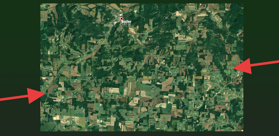
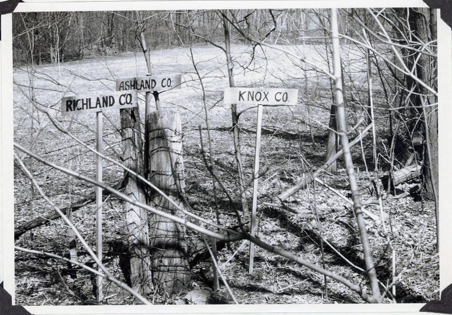
If you want to find the Greenville Treaty Line in Richland County today you can simply go to the odd corner of Richland County. It is marked there far more clearly than it ever was when its presence in the forest had significance:

Post Script:
Studying the two Federal treaties that preceded U.S. settlement of North Central Ohio, I discovered an awkward dilemma: the first 1795 Treaty of Greenville gave the U.S. possession of all the land EAST of the Cuyahoga River; the second 1805 treaty at Swan Creek transferred ownership of all the lands WEST of the Cuyahoga.
Neither treaty claimed the river itself.
The Cuyahoga River apparently still remains in the custody of the Wyandot, Lenape, Shawnee, Ottawa, Miami, Chippewa, Potawatomi, and Kaskaskia nations.