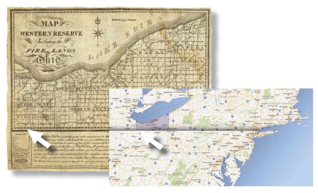
If you go to the State of Connecticut, and travel as far south as it is possible to go within the state—to where you’re standing with your toes in the Long Island Sound—and then face due west and start walking in a razor-straight line: in 469.5 miles you will be standing on Main Street in Plymouth, Richland County, Ohio. There is a reason for that—it’s called the 41st Parallel.
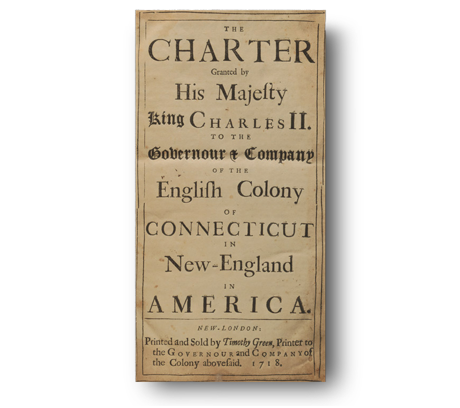
It seems like Plymouth’s principle thoroughfare should be a product of Richland County history, but in fact the course of Main Street was determined by Charles the Second, By the grace of God, King of England, Scotland, France and Ireland, defender of the Faith, &c.
In 1662 the King signed a charter for the Colony of Connecticut that granted them lands in the New World—in the new England—that ran in a line along the 41st Parallel from the Atlantic Ocean on the east to the “South Sea on the West parte,” which is to say the Pacific Ocean. This charter included “Soyles, Grounds, Havens, Ports, Rivers, Waters, Fishings, Mynes, Myneralls, Precious Stones, Quarries and all singular other Comodities.”
Their grant also included all the neighborhoods in the northern half of Plymouth.
The Forty-First Parallel
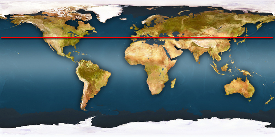
If you’ve heard of this line at all it is probably in reference to US states out west, because the 41st Parallel is that arrow-straight line you see on the map dividing Nebraska and Wyoming from Utah and Colorado. It runs all the way around the globe, the same distance from the equator, through some pretty interesting places like Spain, Italy, Greece, China and Japan.
The folks in Connecticut hung on to their granted lands out west of New England for as long as the could. In the 1700s, when the young United States was plotting its western expansion, Congress got Connecticut to cede a lot of its charter claim to the greater good, but those wily Yankees held back one big chunk in reserve. Today that chunk is the northeastern corner of Ohio known as the Western Reserve.
During the Revolutionary War the colony of Connecticut suffered terrible raids along the coast when British troops set fire to towns close to the ocean. After the war the colony offered to compensate folks who lost their homes to fire, by giving them land out west in their Western Reserve. That was how the Firelands came to be.
If you look at a map of the Firelands in Ohio—land that was settled by people displaced from Connecticut—you’ll find the names of the towns are all the same as those on the coast of Connecticut: Norwalk, Greenwich, Fairfield, New Haven.
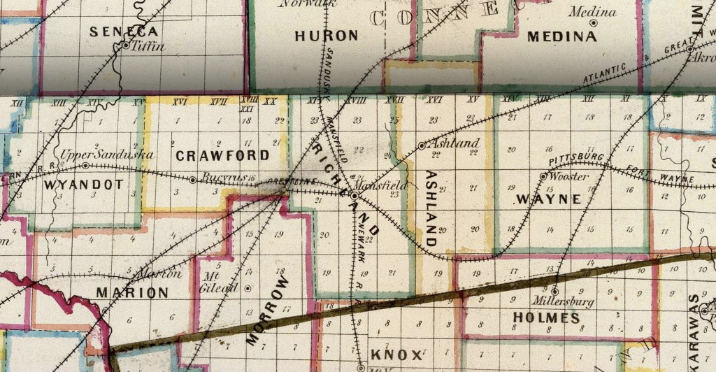
These Firelands ride atop the 41st Parallel, and that line is also the northern boundary of Richland County. Straddling that line is the village of Plymouth.

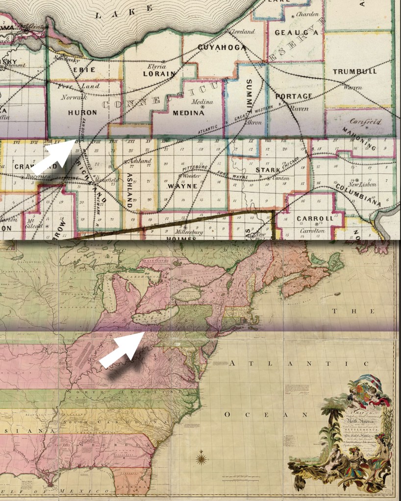
The southern boundary of the land granted to Connecticut followed the 41st Parallel. In 1803 it became the northern boundary of Richland County.
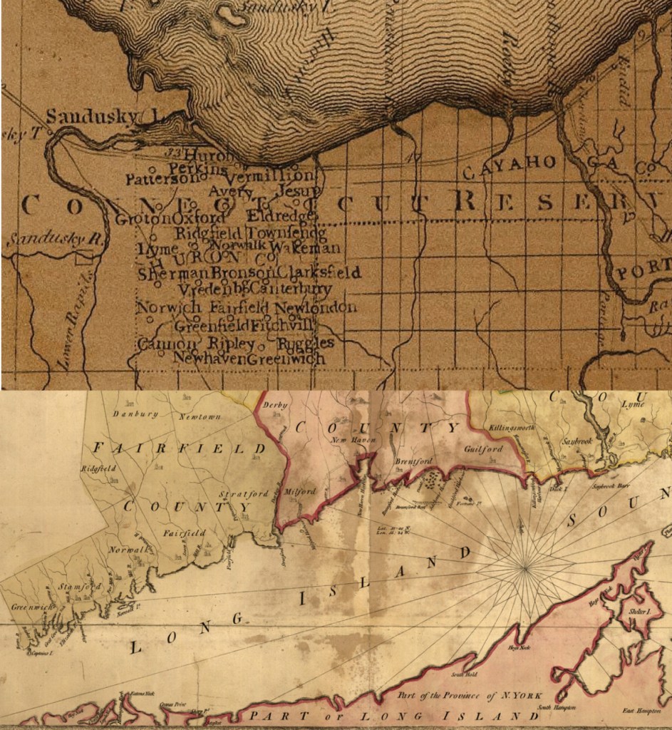
Drive through Huron County and you’ll find Norwalk, Greenwich, Fairfield & New Haven just the same as you will find north of the Long Island Sound.
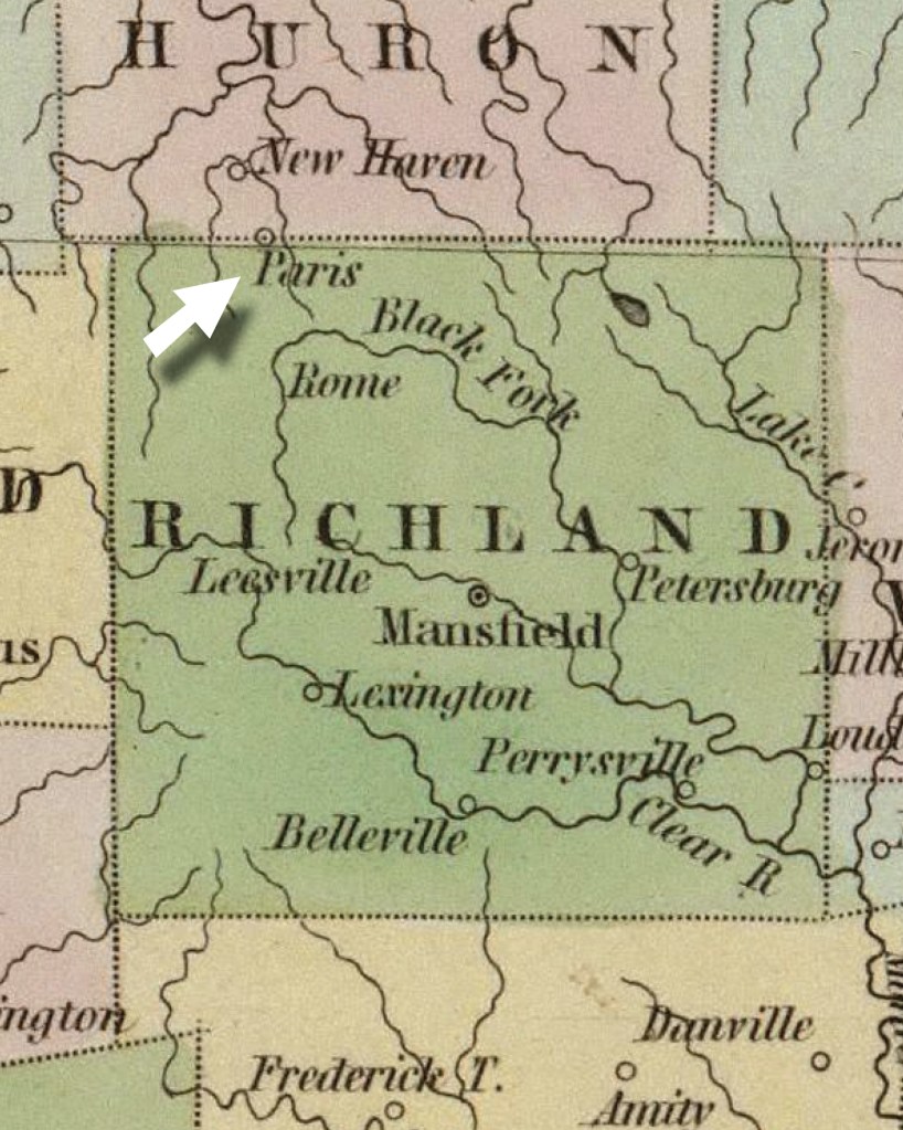
Paris, Ohio Becomes Plymouth OH
The settlers who took root in the northern end of Richland County had some pretty big dreams when they laid out their communities in the early 1800s. One little crossroads was named Rome, and five miles away was London, and six miles from there was Paris. They projected all of Europe crammed into three townships.
The little hamlet called Paris grew haphazardly and ‘spontaneously as a mushroom,’ and actually comprised a little town before it was even laid out in 1825. When they finally got around to mapping out the plat, the town was already straddled across the dividing line between Richland County and the Firelands. The name Paris was accepted more or less in a similarly vague manner.
At that time you could flip a coin to guess on which side of the fence the burg might fall: in the Yankee northern part, or the southern Richland part. In the 1840s when plans showed that the railroad line connecting Mansfield to the port of Sandusky was going to pass right through their community, the town fathers recognized that their town could actually amount to something, so they took decisive action and renamed their town with a definitive label.
In honor of the New England coast from which they derived their pivotal axis, they named it after America’s first landfall at Plymouth Rock.
Telltale Signs
Of course today when you go through Plymouth the town exhibits every characteristic charm of typical Richland Midwestern Americana, but if you look closely you’ll notice a little clue that serves as a sign tracing its cultural DNA back to those Connecticut roots.
It has to do with the shape of the Square—because it’s not a square at all…it’s more of a rhombus/ trapezoid/triangle quadrilateral/irregular polygon shape. Look at maps of villages in Connecticut from colonial days and you’ll find their village greens have exactly that same pattern.
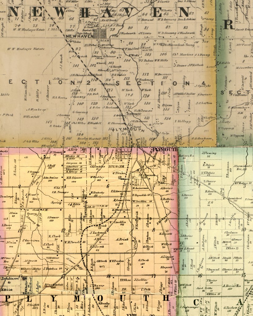
This composite image of Plymouth joins together the 1856 Richland County and the 1859 Huron County wall maps.
